Cuca geodata
Cuca (Galaţi) is a seat of a second-order administrative division; located in Romania in Europe/Bucharest (GMT+3) time zone. With population of 2,580 people, there are 2084 cities with bigger population in this country. Compared to other cities in Romania, 51.3% of cities are located further ↑North; 95.2% of cities are located further ←West and 60.6% of cities have higher elevation than Cuca. Note1


Cuca GPS coordinates[2]
45° 43' 59.988" North, 27° 52' 59.988" East
| Map corner | latitude | longitude |
|---|---|---|
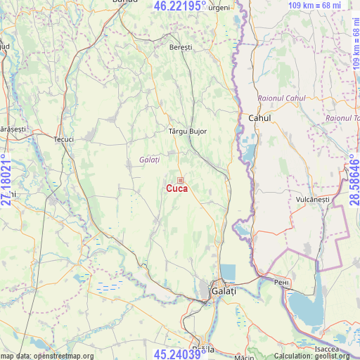
| Upper-left | 46.22195°, | 27.18021° |
| Center: | 45.73333°, | 27.88333° |
| Lower-right: | 45.24039°, | 28.58646° |
| Map W x H: | 109.1×109.1 km | = 67.8×67.8mi |
| max Lat: | 48.23793° ⇑51.3% North |
| Cuca: | 45.73333° |
| min Lat: | ⇓48.7% South 43.65638° |
| min Long | Cuca | max Long |
| 20.31667° | 27.88333° | 29.65403° |
| W 95.2%⇐ | ⇒4.8% E |
Elevation
Elevation of Cuca is 164 m = 538 ft, and this is 90.9 m = 298 ft below average elevation for this country.
| Max E: |
1278 m = 4193 ft | 60.6% |
| Avg. | 254.9 m = 836 ft | |
| Cuca | 164 m = 538 ft | |
Min E: |
-2 m = -7 ft | 39.4% |
See also: Romania elevation on elevation.city.
Geographical zone
Cuca is located in North temperate zone (between Tropic of Cancer and the Arctic Circle). Distance of this North polar circle is 2316.1 km =1439.2 mi to North.| Distance of | km | miles | from Cuca |
|---|---|---|---|
| North Pole | 4922 | 3058.4 | to North |
| Arctic Circle | 2316.1 | 1439.2 | to North |
| Tropic Cancer | 2479.2 | 1540.5 | to South |
| Equator | 5085.1 | 3159.7 | to South |


Nearby cities:
15 places around Cuca: (largest is in red/bold)
• Băleni
10 km =6.2 mi,  337°
337°
• Chiraftei
12 km =7.5 mi,  68°
68°
• Costache Negri
13.5 km =8.4 mi,  254°
254°
• Folteşti
13.1 km =8.1 mi,  81°
81°
• Fântânele
10 km =6.2 mi,  110°
110°
• Fârţăneşti
12.1 km =7.5 mi,  39°
39°
• Măstăcani
12.9 km =8 mi,  64°
64°
• Pechea
12.9 km =8 mi,  210°
210°
• Plevna
2.4 km =1.5 mi,  256°
256°
• Rediu
4.3 km =2.7 mi,  244°
244°
• Scânteiești
9.5 km =5.9 mi,  125°
125°
• Suhurlui
4.4 km =2.7 mi, 263°
• Târgu Bujor
14.9 km =9.3 mi,  4°
4°
• Umbrărești
13.1 km =8.1 mi,  12°
12°
• Viile
9.6 km =6 mi,  31°
31°
Sources, notices
• [Note1] Compared only with cities in Romania existing in our database
• [Src1] Map data: © OpenStreetMap contributors (CC-BY-SA)
• [Src2] Other city data from geonames.org with taken over terms of usage.
• [Src3] Geographical zone / Annual Mean Temperature by Robert A. Rohde @ Wikipedia
