Tirimia geodata
Tirimia (Mureş) is a populated place; located in Romania in Europe/Bucharest (GMT+3) time zone. With population of 801 people, there are 5041 cities with bigger population in this country. Compared to other cities in Romania, 65.8% of cities are located further ↓South; 60.4% of cities are located further →East and 68.4% of cities have lower elevation than Tirimia. Note1


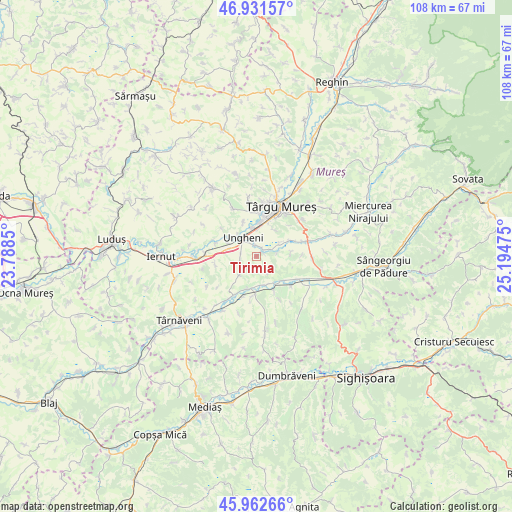
Tirimia GPS coordinates[2]
46° 26' 57.372" North, 24° 29' 29.832" East
| Map corner | latitude | longitude |
|---|---|---|
| Upper-left | 46.93157°, | 23.7885° |
| Center: | 46.44927°, | 24.49162° |
| Lower-right: | 45.96266°, | 25.19475° |
| Map W x H: | 107.7×107.7 km | = 66.9×66.9mi |
| max Lat: | 48.23793° ⇑34.2% North |
| Tirimia: | 46.44927° |
| min Lat: | ⇓65.8% South 43.65638° |
| min Long | Tirimia | max Long |
| 20.31667° | 24.49162° | 29.65403° |
| W 39.6%⇐ | ⇒60.4% E |
Elevation
Elevation of Tirimia is 309 m = 1014 ft, and this is 54.1 m = 177 ft above average elevation for this country.
| Max E: |
1278 m = 4193 ft | 31.6% |
| Tirimia | 309 m 1014 ft | |
| Avg. | 254.9 m = 836 ft | |
Min E: |
-2 m = -7 ft | 68.4% |
See also: Romania elevation on elevation.city.
Geographical zone
Tirimia is located in North temperate zone (between Tropic of Cancer and the Arctic Circle). Distance of this North polar circle is 2236.5 km =1389.7 mi to North.| Distance of | km | miles | from Tirimia |
|---|---|---|---|
| North Pole | 4842.4 | 3008.9 | to North |
| Arctic Circle | 2236.5 | 1389.7 | to North |
| Tropic Cancer | 2558.8 | 1590 | to South |
| Equator | 5164.7 | 3209.2 | to South |


Nearby cities:
15 places around Tirimia: (largest is in red/bold)
• Bahnea
9.2 km =5.7 mi,  183°
183°
• Cerghid
5.2 km =3.2 mi,  222°
222°
• Cerghizel
3.4 km =2.1 mi,  259°
259°
• Chirileu
8.9 km =5.5 mi,  290°
290°
• Cornești
7.1 km =4.4 mi,  85°
85°
• Cristeşti
5.7 km =3.5 mi,  353°
353°
• Crăciuneşti
7.7 km =4.8 mi,  64°
64°
• Gheorghe Doja
2 km =1.2 mi,  18°
18°
• Idrifaia
7.2 km =4.5 mi,  196°
196°
• Odrihei
7.7 km =4.8 mi,  130°
130°
• Satu Nou
1.8 km =1.1 mi, 62°
• Suplac
7.6 km =4.7 mi,  165°
165°
• Ungheni
4.2 km =2.6 mi,  333°
333°
• Valea Izvoarelor
8.9 km =5.5 mi, 262°
• Vidrasău
6.5 km =4 mi,  296°
296°
Sources, notices
• [Note1] Compared only with cities in Romania existing in our database
• [Src1] Map data: © OpenStreetMap contributors (CC-BY-SA)
• [Src2] Other city data from geonames.org with taken over terms of usage.
• [Src3] Geographical zone / Annual Mean Temperature by Robert A. Rohde @ Wikipedia
