Corbu geodata
Corbu (Constanța) is a seat of a second-order administrative division; located in Romania in Europe/Bucharest (GMT+3) time zone. With population of 5,180 people, there are 725 cities with bigger population in this country. Compared to other cities in Romania, 88.7% of cities are located further ↑North; 99.4% of cities are located further ←West and 99.7% of cities have higher elevation than Corbu. Note1


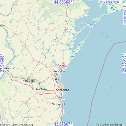
Corbu GPS coordinates[2]
44° 22' 59.988" North, 28° 39' 0" East
| Map corner | latitude | longitude |
|---|---|---|
| Upper-left | 44.88368°, | 27.94688° |
| Center: | 44.38333°, | 28.65° |
| Lower-right: | 43.87867°, | 29.35313° |
| Map W x H: | 111.7×111.7 km | = 69.4×69.4mi |
| max Lat: | 48.23793° ⇑88.7% North |
| Corbu: | 44.38333° |
| min Lat: | ⇓11.3% South 43.65638° |
| min Long | Corbu | max Long |
| 20.31667° | 28.65° | 29.65403° |
| W 99.4%⇐ | ⇒0.59999999999999% E |
Elevation
Elevation of Corbu is 4 m = 13 ft, and this is 250.9 m = 823 ft below average elevation for this country.
| Max E: |
1278 m = 4193 ft | 99.7% |
| Avg. | 254.9 m = 836 ft | |
| Corbu | 4 m = 13 ft | |
Min E: |
-2 m = -7 ft | 0.3% |
See also: Romania elevation on elevation.city.
Geographical zone
Corbu is located in North temperate zone (between Tropic of Cancer and the Arctic Circle). Distance of this Northern Tropic circle is 2329 km =1447.2 mi to South.| Distance of | km | miles | from Corbu |
|---|---|---|---|
| North Pole | 5072.1 | 3151.7 | to North |
| Arctic Circle | 2466.2 | 1532.4 | to North |
| Tropic Cancer | 2329 | 1447.2 | to South |
| Equator | 4935 | 3066.5 | to South |


Nearby cities:
15 places around Corbu: (largest is in red/bold)
• Cogealac
19.7 km =12.2 mi,  340°
340°
• Culmea
20.2 km =12.6 mi,  226°
226°
• Lumina
12.9 km =8 mi,  210°
210°
• Mamaia-Sat
8.2 km =5.1 mi,  193°
193°
• Mihail Kogălniceanu
15.2 km =9.4 mi,  263°
263°
• Nuntași
17.1 km =10.6 mi,  359°
359°
• Năvodari
8.4 km =5.2 mi, 208°
• Oituz
11.7 km =7.3 mi,  239°
239°
• Ovidiu
15.6 km =9.7 mi, 206°
• Palazu Mare
17.6 km =10.9 mi, 192°
• Piatra
7.4 km =4.6 mi,  288°
288°
• Săcele
11.1 km =6.9 mi,  0°
0°
• Tariverde
20.3 km =12.6 mi,  349°
349°
• Târguşor
20 km =12.4 mi, 291°
• Vadu
10.2 km =6.3 mi,  42°
42°
Sources, notices
• [Note1] Compared only with cities in Romania existing in our database
• [Src1] Map data: © OpenStreetMap contributors (CC-BY-SA)
• [Src2] Other city data from geonames.org with taken over terms of usage.
• [Src3] Geographical zone / Annual Mean Temperature by Robert A. Rohde @ Wikipedia
