Conduratu geodata
Conduratu (Prahova) is a populated place; located in Romania in Europe/Bucharest (GMT+3) time zone. With population of 1,290 people, there are 3547 cities with bigger population in this country. Compared to other cities in Romania, 70.6% of cities are located further ↑North; 71.4% of cities are located further ←West and 75.6% of cities have higher elevation than Conduratu. Note1


Conduratu GPS coordinates[2]
44° 58' 20.496" North, 26° 26' 1.14" East
| Map corner | latitude | longitude |
|---|---|---|
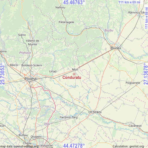
| Upper-left | 45.46763°, | 25.73053° |
| Center: | 44.97236°, | 26.43365° |
| Lower-right: | 44.47278°, | 27.13678° |
| Map W x H: | 110.6×110.6 km | = 68.7×68.7mi |
| max Lat: | 48.23793° ⇑70.6% North |
| Conduratu: | 44.97236° |
| min Lat: | ⇓29.4% South 43.65638° |
| min Long | Conduratu | max Long |
| 20.31667° | 26.43365° | 29.65403° |
| W 71.4%⇐ | ⇒28.6% E |
Elevation
Elevation of Conduratu is 108 m = 354 ft, and this is 146.9 m = 482 ft below average elevation for this country.
| Max E: |
1278 m = 4193 ft | 75.6% |
| Avg. | 254.9 m = 836 ft | |
| Conduratu | 108 m = 354 ft | |
Min E: |
-2 m = -7 ft | 24.4% |
See also: Romania elevation on elevation.city.
Geographical zone
Conduratu is located in North temperate zone (between Tropic of Cancer and the Arctic Circle). Distance of this Northern Tropic circle is 2394.5 km =1487.9 mi to South.| Distance of | km | miles | from Conduratu |
|---|---|---|---|
| North Pole | 5006.6 | 3111 | to North |
| Arctic Circle | 2400.7 | 1491.7 | to North |
| Tropic Cancer | 2394.5 | 1487.9 | to South |
| Equator | 5000.5 | 3107.2 | to South |


Nearby cities:
15 places around Conduratu: (largest is in red/bold)
• Baba Ana
1.4 km =0.9 mi,  116°
116°
• Cireșanu
6.2 km =3.9 mi,  81°
81°
• Colceag
7 km =4.3 mi,  249°
249°
• Fefelei
4.6 km =2.9 mi,  7°
7°
• Fulga de Sus
8.1 km =5 mi,  170°
170°
• Fântânele
5.9 km =3.7 mi,  310°
310°
• Gura Vadului
9 km =5.6 mi,  16°
16°
• Inotești
6.1 km =3.8 mi,  258°
258°
• Mizil
5.1 km =3.2 mi, 14°
• Parepa-Rușani
9.7 km =6 mi,  219°
219°
• Perșunari
9.5 km =5.9 mi, 6°
• Săhăteni
9.4 km =5.8 mi,  43°
43°
• Ungureni
7.9 km =4.9 mi,  331°
331°
• Vadu Săpat
8.3 km =5.2 mi, 333°
• Vâlcelele
5.5 km =3.4 mi,  228°
228°
Sources, notices
• [Note1] Compared only with cities in Romania existing in our database
• [Src1] Map data: © OpenStreetMap contributors (CC-BY-SA)
• [Src2] Other city data from geonames.org with taken over terms of usage.
• [Src3] Geographical zone / Annual Mean Temperature by Robert A. Rohde @ Wikipedia
