Coltău geodata
Coltău (Maramureş) is a seat of a second-order administrative division; located in Romania in Europe/Bucharest (GMT+3) time zone. With population of 1,583 people, there are 3070 cities with bigger population in this country. Compared to other cities in Romania, 92.9% of cities are located further ↓South; 76.6% of cities are located further →East and 59.2% of cities have higher elevation than Coltău. Note1


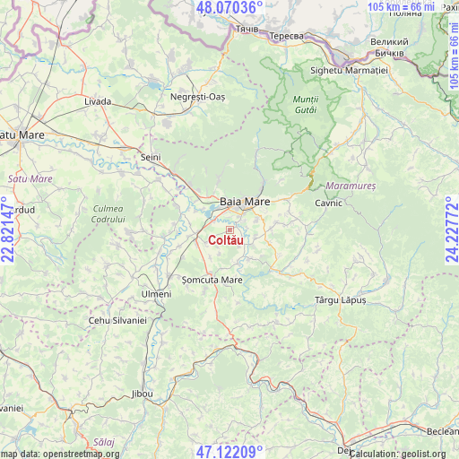
Coltău GPS coordinates[2]
47° 35' 54.132" North, 23° 31' 28.524" East
| Map corner | latitude | longitude |
|---|---|---|
| Upper-left | 48.07036°, | 22.82147° |
| Center: | 47.59837°, | 23.52459° |
| Lower-right: | 47.12209°, | 24.22772° |
| Map W x H: | 105.4×105.4 km | = 65.5×65.5mi |
| max Lat: | 48.23793° ⇑7.1% North |
| Coltău: | 47.59837° |
| min Lat: | ⇓92.9% South 43.65638° |
| min Long | Coltău | max Long |
| 20.31667° | 23.52459° | 29.65403° |
| W 23.4%⇐ | ⇒76.6% E |
Elevation
Elevation of Coltău is 169 m = 554 ft, and this is 85.9 m = 282 ft below average elevation for this country.
| Max E: |
1278 m = 4193 ft | 59.2% |
| Avg. | 254.9 m = 836 ft | |
| Coltău | 169 m = 554 ft | |
Min E: |
-2 m = -7 ft | 40.8% |
See also: Romania elevation on elevation.city.
Geographical zone
Coltău is located in North temperate zone (between Tropic of Cancer and the Arctic Circle). Distance of this North polar circle is 2108.7 km =1310.3 mi to North.| Distance of | km | miles | from Coltău |
|---|---|---|---|
| North Pole | 4714.6 | 2929.5 | to North |
| Arctic Circle | 2108.7 | 1310.3 | to North |
| Tropic Cancer | 2686.5 | 1669.3 | to South |
| Equator | 5292.4 | 3288.5 | to South |


Nearby cities:
15 places around Coltău: (largest is in red/bold)
• Baia Mare
7.3 km =4.5 mi,  26°
26°
• Chechiș
6.1 km =3.8 mi,  104°
104°
• Coruia
6.7 km =4.2 mi,  125°
125°
• Culcea
4.3 km =2.7 mi,  147°
147°
• Finteușu Mic
6.3 km =3.9 mi,  237°
237°
• Groşi
7.2 km =4.5 mi,  73°
73°
• Lăpușel
4.1 km =2.5 mi,  303°
303°
• Mocira
2.7 km =1.7 mi,  0°
0°
• Recea
3.9 km =2.4 mi,  351°
351°
• Remetea Chioarului
7.5 km =4.7 mi,  165°
165°
• Satu Nou de Jos
3.8 km =2.4 mi,  58°
58°
• Satulung
7.7 km =4.8 mi, 242°
• Săcălășeni
3.5 km =2.2 mi,  121°
121°
• Săsar
5.4 km =3.4 mi,  339°
339°
• Tăuții-Măgherăuș
6.5 km =4 mi,  331°
331°
Sources, notices
• [Note1] Compared only with cities in Romania existing in our database
• [Src1] Map data: © OpenStreetMap contributors (CC-BY-SA)
• [Src2] Other city data from geonames.org with taken over terms of usage.
• [Src3] Geographical zone / Annual Mean Temperature by Robert A. Rohde @ Wikipedia
