Cojocna geodata
Cojocna (Cluj) is a seat of a second-order administrative division; located in Romania in Europe/Bucharest (GMT+3) time zone. With population of 4,336 people, there are 1030 cities with bigger population in this country. Compared to other cities in Romania, 72.8% of cities are located further ↓South; 72.1% of cities are located further →East and 70.7% of cities have lower elevation than Cojocna. Note1


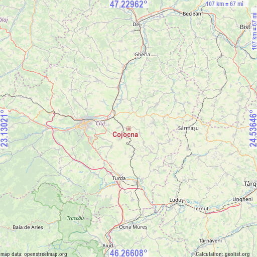
Cojocna GPS coordinates[2]
46° 45' 0" North, 23° 49' 59.988" East
| Map corner | latitude | longitude |
|---|---|---|
| Upper-left | 47.22962°, | 23.13021° |
| Center: | 46.75°, | 23.83333° |
| Lower-right: | 46.26608°, | 24.53646° |
| Map W x H: | 107.1×107.1 km | = 66.5×66.5mi |
| max Lat: | 48.23793° ⇑27.2% North |
| Cojocna: | 46.75° |
| min Lat: | ⇓72.8% South 43.65638° |
| min Long | Cojocna | max Long |
| 20.31667° | 23.83333° | 29.65403° |
| W 27.9%⇐ | ⇒72.1% E |
Elevation
Elevation of Cojocna is 326 m = 1070 ft, and this is 71.1 m = 233 ft above average elevation for this country.
| Max E: |
1278 m = 4193 ft | 29.3% |
| Cojocna | 326 m 1070 ft | |
| Avg. | 254.9 m = 836 ft | |
Min E: |
-2 m = -7 ft | 70.7% |
See also: Romania elevation on elevation.city.
Geographical zone
Cojocna is located in North temperate zone (between Tropic of Cancer and the Arctic Circle). Distance of this North polar circle is 2203.1 km =1368.9 mi to North.| Distance of | km | miles | from Cojocna |
|---|---|---|---|
| North Pole | 4808.9 | 2988.1 | to North |
| Arctic Circle | 2203.1 | 1368.9 | to North |
| Tropic Cancer | 2592.2 | 1610.7 | to South |
| Equator | 5198.1 | 3229.9 | to South |


Nearby cities:
15 places around Cojocna: (largest is in red/bold)
• Aiton
10.6 km =6.6 mi,  225°
225°
• Apahida
9.8 km =6.1 mi,  319°
319°
• Boju
5.9 km =3.7 mi,  221°
221°
• Cara
4.1 km =2.5 mi,  278°
278°
• Corpadea
4.7 km =2.9 mi,  355°
355°
• Căianu
7.5 km =4.7 mi,  59°
59°
• Căianu Mic
7.3 km =4.5 mi, 59°
• Dezmir
8.5 km =5.3 mi, 281°
• Gheorghieni
11.7 km =7.3 mi,  250°
250°
• Gădălin
10.1 km =6.3 mi,  6°
6°
• Jucu de Mijloc
11.2 km =7 mi,  336°
336°
• Pata
7.1 km =4.4 mi, 248°
• Ploscoș
11.9 km =7.4 mi,  175°
175°
• Suatu
10.3 km =6.4 mi,  79°
79°
• Sânnicoară
9.3 km =5.8 mi,  298°
298°
Sources, notices
• [Note1] Compared only with cities in Romania existing in our database
• [Src1] Map data: © OpenStreetMap contributors (CC-BY-SA)
• [Src2] Other city data from geonames.org with taken over terms of usage.
• [Src3] Geographical zone / Annual Mean Temperature by Robert A. Rohde @ Wikipedia
