Cherechiu geodata
Cherechiu (Bihor) is a seat of a second-order administrative division; located in Romania in Europe/Bucharest (GMT+3) time zone. With population of 2,437 people, there are 2212 cities with bigger population in this country. Compared to other cities in Romania, 88.4% of cities are located further ↓South; 93.3% of cities are located further →East and 77% of cities have higher elevation than Cherechiu. Note1


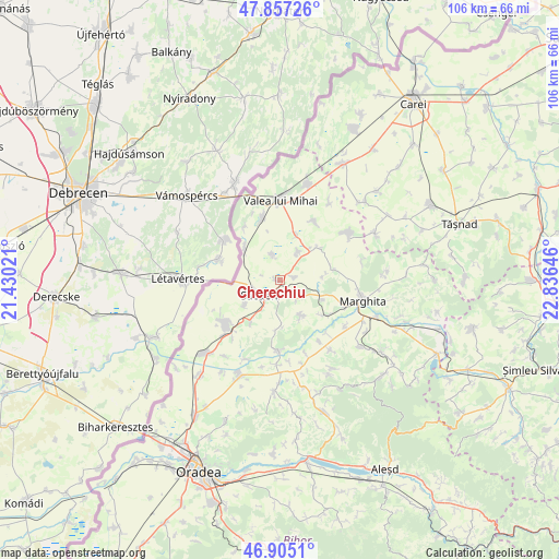
Cherechiu GPS coordinates[2]
47° 22' 59.988" North, 22° 7' 59.988" East
| Map corner | latitude | longitude |
|---|---|---|
| Upper-left | 47.85726°, | 21.43021° |
| Center: | 47.38333°, | 22.13333° |
| Lower-right: | 46.9051°, | 22.83646° |
| Map W x H: | 105.9×105.9 km | = 65.8×65.8mi |
| max Lat: | 48.23793° ⇑11.6% North |
| Cherechiu: | 47.38333° |
| min Lat: | ⇓88.4% South 43.65638° |
| min Long | Cherechiu | max Long |
| 20.31667° | 22.13333° | 29.65403° |
| W 6.7%⇐ | ⇒93.3% E |
Elevation
Elevation of Cherechiu is 104 m = 341 ft, and this is 150.9 m = 495 ft below average elevation for this country.
| Max E: |
1278 m = 4193 ft | 77% |
| Avg. | 254.9 m = 836 ft | |
| Cherechiu | 104 m = 341 ft | |
Min E: |
-2 m = -7 ft | 23% |
See also: Romania elevation on elevation.city.
Geographical zone
Cherechiu is located in North temperate zone (between Tropic of Cancer and the Arctic Circle). Distance of this North polar circle is 2132.6 km =1325.1 mi to North.| Distance of | km | miles | from Cherechiu |
|---|---|---|---|
| North Pole | 4738.5 | 2944.4 | to North |
| Arctic Circle | 2132.6 | 1325.1 | to North |
| Tropic Cancer | 2662.6 | 1654.5 | to South |
| Equator | 5268.5 | 3273.7 | to South |


Nearby cities:
15 places around Cherechiu: (largest is in red/bold)
• Adoni
6.3 km =3.9 mi,  30°
30°
• Albiș
8.5 km =5.3 mi,  84°
84°
• Buduslău
10.2 km =6.3 mi, 79°
• Cadea
9.6 km =6 mi,  213°
213°
• Cheșereu
5.1 km =3.2 mi,  343°
343°
• Ciocaia
8.2 km =5.1 mi,  233°
233°
• Cubulcut
7.8 km =4.8 mi,  149°
149°
• Olosig
4.9 km =3 mi,  135°
135°
• Otomani
9.9 km =6.2 mi,  52°
52°
• Sânnicolau de Munte
8.9 km =5.5 mi,  178°
178°
• Săcueni
4.5 km =2.8 mi, 214°
• Tarcea
8.3 km =5.2 mi, 26°
• Târgușor
2.5 km =1.6 mi,  90°
90°
• Şimian
11.4 km =7.1 mi,  347°
347°
• Șilindru
8.8 km =5.5 mi,  312°
312°
Sources, notices
• [Note1] Compared only with cities in Romania existing in our database
• [Src1] Map data: © OpenStreetMap contributors (CC-BY-SA)
• [Src2] Other city data from geonames.org with taken over terms of usage.
• [Src3] Geographical zone / Annual Mean Temperature by Robert A. Rohde @ Wikipedia
