Cernelele de Sus geodata
Cernelele de Sus (Dolj) is a populated place; located in Romania in Europe/Bucharest (GMT+3) time zone. With population of 864 people, there are 4779 cities with bigger population in this country. Compared to other cities in Romania, 89.9% of cities are located further ↑North; 73.6% of cities are located further →East and 83.8% of cities have higher elevation than Cernelele de Sus. Note1


Cernelele de Sus GPS coordinates[2]
44° 20' 17.052" North, 23° 44' 22.812" East
| Map corner | latitude | longitude |
|---|---|---|
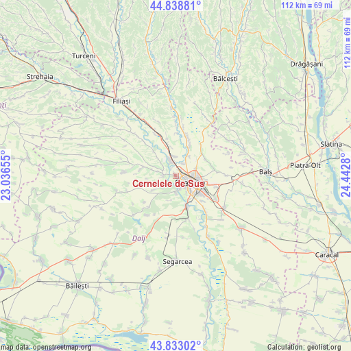
| Upper-left | 44.83881°, | 23.03655° |
| Center: | 44.33807°, | 23.73967° |
| Lower-right: | 43.83302°, | 24.4428° |
| Map W x H: | 111.8×111.8 km | = 69.5×69.5mi |
| max Lat: | 48.23793° ⇑89.9% North |
| Cernelele de Sus: | 44.33807° |
| min Lat: | ⇓10.1% South 43.65638° |
| min Long | Cernelele de Su | max Long |
| 20.31667° | 23.73967° | 29.65403° |
| W 26.4%⇐ | ⇒73.6% E |
Elevation
Elevation of Cernelele de Sus is 82 m = 269 ft, and this is 172.9 m = 567 ft below average elevation for this country.
| Max E: |
1278 m = 4193 ft | 83.8% |
| Avg. | 254.9 m = 836 ft | |
| Cernelele de Sus | 82 m = 269 ft | |
Min E: |
-2 m = -7 ft | 16.2% |
See also: Romania elevation on elevation.city.
Geographical zone
Cernelele de Sus is located in North temperate zone (between Tropic of Cancer and the Arctic Circle). Distance of this Northern Tropic circle is 2324 km =1444.1 mi to South.| Distance of | km | miles | from Cernelele de Sus |
|---|---|---|---|
| North Pole | 5077.1 | 3154.8 | to North |
| Arctic Circle | 2471.2 | 1535.5 | to North |
| Tropic Cancer | 2324 | 1444.1 | to South |
| Equator | 4929.9 | 3063.3 | to South |


Nearby cities:
15 places around Cernelele de Sus: (largest is in red/bold)
• Albești
4.6 km =2.9 mi,  28°
28°
• Breasta
4.5 km =2.8 mi,  263°
263°
• Bucovăţ
4.3 km =2.7 mi,  169°
169°
• Cernele
0.5 km =0.3 mi,  164°
164°
• Craiova
5.4 km =3.4 mi,  116°
116°
• Izvorul Rece
2.3 km =1.4 mi, 27°
• Işalniţa
6.9 km =4.3 mi,  355°
355°
• Mofleni
4.3 km =2.7 mi, 159°
• Palilula
7.8 km =4.8 mi,  190°
190°
• Popoveni
6.5 km =4 mi,  148°
148°
• Rovine
3 km =1.9 mi,  329°
329°
• Sărbătoarea
8.2 km =5.1 mi,  237°
237°
• Valea Lungului
5.9 km =3.7 mi,  284°
284°
• Şimnicu de Sus
7 km =4.3 mi,  43°
43°
• Șimnicu de Jos
6.9 km =4.3 mi,  69°
69°
Sources, notices
• [Note1] Compared only with cities in Romania existing in our database
• [Src1] Map data: © OpenStreetMap contributors (CC-BY-SA)
• [Src2] Other city data from geonames.org with taken over terms of usage.
• [Src3] Geographical zone / Annual Mean Temperature by Robert A. Rohde @ Wikipedia
