Bucovăţ geodata
Bucovăţ (Dolj) is a seat of a second-order administrative division; located in Romania in Europe/Bucharest (GMT+3) time zone. With population of 4,175 people, there are 1103 cities with bigger population in this country. Compared to other cities in Romania, 90.8% of cities are located further ↑North; 73.4% of cities are located further →East and 86.8% of cities have higher elevation than Bucovăţ. Note1


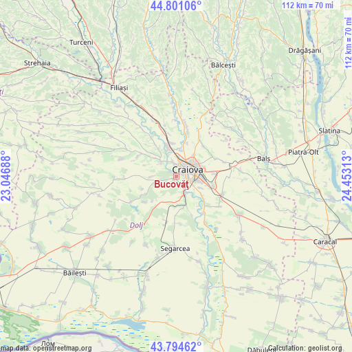
Bucovăţ GPS coordinates[2]
44° 18' 0" North, 23° 45' 0" East
| Map corner | latitude | longitude |
|---|---|---|
| Upper-left | 44.80106°, | 23.04688° |
| Center: | 44.3°, | 23.75° |
| Lower-right: | 43.79462°, | 24.45313° |
| Map W x H: | 111.9×111.9 km | = 69.5×69.5mi |
| max Lat: | 48.23793° ⇑90.8% North |
| Bucovăţ: | 44.3° |
| min Lat: | ⇓9.2% South 43.65638° |
| min Long | Bucovăţ | max Long |
| 20.31667° | 23.75° | 29.65403° |
| W 26.6%⇐ | ⇒73.4% E |
Elevation
Elevation of Bucovăţ is 72 m = 236 ft, and this is 182.9 m = 600 ft below average elevation for this country.
| Max E: |
1278 m = 4193 ft | 86.8% |
| Avg. | 254.9 m = 836 ft | |
| Bucovăţ | 72 m = 236 ft | |
Min E: |
-2 m = -7 ft | 13.2% |
See also: Romania elevation on elevation.city.
Geographical zone
Bucovăţ is located in North temperate zone (between Tropic of Cancer and the Arctic Circle). Distance of this Northern Tropic circle is 2319.8 km =1441.5 mi to South.| Distance of | km | miles | from Bucovăţ |
|---|---|---|---|
| North Pole | 5081.4 | 3157.4 | to North |
| Arctic Circle | 2475.5 | 1538.2 | to North |
| Tropic Cancer | 2319.8 | 1441.5 | to South |
| Equator | 4925.7 | 3060.7 | to South |


Nearby cities:
15 places around Bucovăţ: (largest is in red/bold)
• Albești
8.4 km =5.2 mi,  9°
9°
• Braniște
4.6 km =2.9 mi,  135°
135°
• Breasta
6.5 km =4 mi,  304°
304°
• Cernele
3.8 km =2.4 mi,  349°
349°
• Cernelele de Sus
4.3 km =2.7 mi, 349°
• Craiova
4.4 km =2.7 mi,  65°
65°
• Făcăi
6.3 km =3.9 mi,  117°
117°
• Izvorul Rece
6.2 km =3.9 mi,  2°
2°
• Livezi
8.3 km =5.2 mi,  157°
157°
• Mofleni
0.7 km =0.4 mi, 70°
• Palilula
4.1 km =2.5 mi,  213°
213°
• Podari
6.2 km =3.9 mi,  154°
154°
• Popoveni
2.9 km =1.8 mi, 117°
• Rovine
7.2 km =4.5 mi,  340°
340°
• Sărbătoarea
7.8 km =4.8 mi,  269°
269°
Sources, notices
• [Note1] Compared only with cities in Romania existing in our database
• [Src1] Map data: © OpenStreetMap contributors (CC-BY-SA)
• [Src2] Other city data from geonames.org with taken over terms of usage.
• [Src3] Geographical zone / Annual Mean Temperature by Robert A. Rohde @ Wikipedia
