Călinești geodata
Călinești (Olt) is a populated place; located in Romania in Europe/Bucharest (GMT+3) time zone. With population of 1,432 people, there are 3282 cities with bigger population in this country. Compared to other cities in Romania, 95.9% of cities are located further ↑North; 57.4% of cities are located further →East and 75.4% of cities have higher elevation than Călinești. Note1


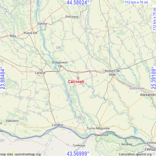
Călinești GPS coordinates[2]
44° 4' 38.172" North, 24° 41' 16.656" East
| Map corner | latitude | longitude |
|---|---|---|
| Upper-left | 44.58024°, | 23.98484° |
| Center: | 44.07727°, | 24.68796° |
| Lower-right: | 43.56999°, | 25.39109° |
| Map W x H: | 112.3×112.3 km | = 69.8×69.8mi |
| max Lat: | 48.23793° ⇑95.9% North |
| Călinești: | 44.07727° |
| min Lat: | ⇓4.1% South 43.65638° |
| min Long | Călinești | max Long |
| 20.31667° | 24.68796° | 29.65403° |
| W 42.6%⇐ | ⇒57.4% E |
Elevation
Elevation of Călinești is 109 m = 358 ft, and this is 145.9 m = 479 ft below average elevation for this country.
| Max E: |
1278 m = 4193 ft | 75.4% |
| Avg. | 254.9 m = 836 ft | |
| Călinești | 109 m = 358 ft | |
Min E: |
-2 m = -7 ft | 24.6% |
See also: Romania elevation on elevation.city.
Geographical zone
Călinești is located in North temperate zone (between Tropic of Cancer and the Arctic Circle). Distance of this Northern Tropic circle is 2295 km =1426 mi to South.| Distance of | km | miles | from Călinești |
|---|---|---|---|
| North Pole | 5106.1 | 3172.8 | to North |
| Arctic Circle | 2500.2 | 1553.6 | to North |
| Tropic Cancer | 2295 | 1426 | to South |
| Equator | 4900.9 | 3045.3 | to South |


Nearby cities:
15 places around Călinești: (largest is in red/bold)
• Beciu
8.3 km =5.2 mi,  192°
192°
• Berindei
10.5 km =6.5 mi,  289°
289°
• Bușca
9.9 km =6.2 mi,  67°
67°
• Bârseștii de Sus
5.2 km =3.2 mi,  199°
199°
• Băbiciu
10.9 km =6.8 mi,  243°
243°
• Băcălești
10.4 km =6.5 mi,  100°
100°
• Cioflanu
10.2 km =6.3 mi,  280°
280°
• Crângeni
9.1 km =5.7 mi,  122°
122°
• Crăciunei
7.9 km =4.9 mi,  345°
345°
• Frunzaru
8.6 km =5.3 mi, 243°
• Ionașcu
11 km =6.8 mi,  110°
110°
• Mihăeşti
9.8 km =6.1 mi,  50°
50°
• Radomireşti
4.4 km =2.7 mi,  355°
355°
• Smârdan
6.9 km =4.3 mi, 195°
• Sprâncenata
4.4 km =2.7 mi, 278°
Sources, notices
• [Note1] Compared only with cities in Romania existing in our database
• [Src1] Map data: © OpenStreetMap contributors (CC-BY-SA)
• [Src2] Other city data from geonames.org with taken over terms of usage.
• [Src3] Geographical zone / Annual Mean Temperature by Robert A. Rohde @ Wikipedia
