Brăeşti geodata
Brăeşti (Botoşani) is a seat of a second-order administrative division; located in Romania in Europe/Bucharest (GMT+3) time zone. With population of 2,222 people, there are 2400 cities with bigger population in this country. Compared to other cities in Romania, 97.5% of cities are located further ↓South; 71.6% of cities are located further ←West and 55% of cities have lower elevation than Brăeşti. Note1


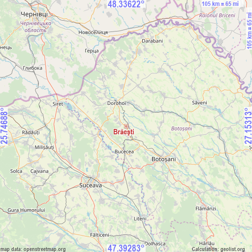
Brăeşti GPS coordinates[2]
47° 52' 0.012" North, 26° 27' 0" East
| Map corner | latitude | longitude |
|---|---|---|
| Upper-left | 48.33622°, | 25.74688° |
| Center: | 47.86667°, | 26.45° |
| Lower-right: | 47.39283°, | 27.15313° |
| Map W x H: | 104.9×104.9 km | = 65.2×65.2mi |
| max Lat: | 48.23793° ⇑2.5% North |
| Brăeşti: | 47.86667° |
| min Lat: | ⇓97.5% South 43.65638° |
| min Long | Brăeşti | max Long |
| 20.31667° | 26.45° | 29.65403° |
| W 71.6%⇐ | ⇒28.4% E |
Elevation
Elevation of Brăeşti is 238 m = 781 ft, and this is 16.9 m = 55 ft below average elevation for this country.
| Max E: |
1278 m = 4193 ft | 45% |
| Avg. | 254.9 m = 836 ft | |
| Brăeşti | 238 m = 781 ft | |
Min E: |
-2 m = -7 ft | 55% |
See also: Romania elevation on elevation.city.
Geographical zone
Brăeşti is located in North temperate zone (between Tropic of Cancer and the Arctic Circle). Distance of this North polar circle is 2078.9 km =1291.8 mi to North.| Distance of | km | miles | from Brăeşti |
|---|---|---|---|
| North Pole | 4684.8 | 2911 | to North |
| Arctic Circle | 2078.9 | 1291.8 | to North |
| Tropic Cancer | 2716.4 | 1687.9 | to South |
| Equator | 5322.3 | 3307.1 | to South |


Nearby cities:
15 places around Brăeşti: (largest is in red/bold)
• Broscăuţi
9.3 km =5.8 mi,  0°
0°
• Bucovineni
8.9 km =5.5 mi,  257°
257°
• Carasa
9.8 km =6.1 mi,  32°
32°
• Cervicești
8.9 km =5.5 mi,  148°
148°
• Corlăteni
10.5 km =6.5 mi,  45°
45°
• Cucorăni
10.6 km =6.6 mi, 151°
• Dimăcheni
8.7 km =5.4 mi,  55°
55°
• Dolina
4.4 km =2.7 mi,  171°
171°
• Dorohoi
10 km =6.2 mi,  338°
338°
• Ionășeni
7.5 km =4.7 mi,  217°
217°
• Leorda
5.6 km =3.5 mi,  180°
180°
• Poiana
3.1 km =1.9 mi, 218°
• Saucenița
5 km =3.1 mi,  307°
307°
• Vârfu Câmpului
9.2 km =5.7 mi, 255°
• Văculeşti
3.1 km =1.9 mi, 306°
Sources, notices
• [Note1] Compared only with cities in Romania existing in our database
• [Src1] Map data: © OpenStreetMap contributors (CC-BY-SA)
• [Src2] Other city data from geonames.org with taken over terms of usage.
• [Src3] Geographical zone / Annual Mean Temperature by Robert A. Rohde @ Wikipedia
