Boșneagu geodata
Boșneagu (Călăraşi) is a populated place; located in Romania in Europe/Bucharest (GMT+3) time zone. With population of 540 people, there are 6681 cities with bigger population in this country. Compared to other cities in Romania, 92.4% of cities are located further ↑North; 81.9% of cities are located further ←West and 95.6% of cities have higher elevation than Boșneagu. Note1


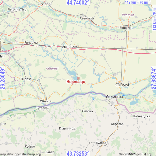
Boșneagu GPS coordinates[2]
44° 14' 18.348" North, 26° 56' 0.996" East
| Map corner | latitude | longitude |
|---|---|---|
| Upper-left | 44.74002°, | 26.23049° |
| Center: | 44.23843°, | 26.93361° |
| Lower-right: | 43.73253°, | 27.63674° |
| Map W x H: | 112×112 km | = 69.6×69.6mi |
| max Lat: | 48.23793° ⇑92.4% North |
| Boșneagu: | 44.23843° |
| min Lat: | ⇓7.6% South 43.65638° |
| min Long | Boșneagu | max Long |
| 20.31667° | 26.93361° | 29.65403° |
| W 81.9%⇐ | ⇒18.1% E |
Elevation
Elevation of Boșneagu is 32 m = 105 ft, and this is 222.9 m = 731 ft below average elevation for this country.
| Max E: |
1278 m = 4193 ft | 95.6% |
| Avg. | 254.9 m = 836 ft | |
| Boșneagu | 32 m = 105 ft | |
Min E: |
-2 m = -7 ft | 4.4% |
See also: Romania elevation on elevation.city.
Geographical zone
Boșneagu is located in North temperate zone (between Tropic of Cancer and the Arctic Circle). Distance of this Northern Tropic circle is 2312.9 km =1437.2 mi to South.| Distance of | km | miles | from Boșneagu |
|---|---|---|---|
| North Pole | 5088.2 | 3161.7 | to North |
| Arctic Circle | 2482.3 | 1542.4 | to North |
| Tropic Cancer | 2312.9 | 1437.2 | to South |
| Equator | 4918.9 | 3056.5 | to South |


Nearby cities:
15 places around Boșneagu: (largest is in red/bold)
• Alexandru Odobescu
12.3 km =7.6 mi,  75°
75°
• Bogata
14.8 km =9.2 mi,  103°
103°
• Chiselet
9.1 km =5.7 mi,  227°
227°
• Ciocăneşti
11.4 km =7.1 mi,  111°
111°
• Coconi
4.1 km =2.5 mi,  284°
284°
• Dorobanţu
2.7 km =1.7 mi,  151°
151°
• Frăsinet
13.7 km =8.5 mi,  309°
309°
• Făurei
6.7 km =4.2 mi,  335°
335°
• Luptători
12.1 km =7.5 mi, 306°
• Mânăstirea
3.6 km =2.2 mi, 227°
• Nicolae Bălcescu
12.7 km =7.9 mi,  65°
65°
• Plevna
14.7 km =9.1 mi,  19°
19°
• Sultana
6.8 km =4.2 mi,  291°
291°
• Ulmu
3.4 km =2.1 mi, 336°
• Vărăști
4.2 km =2.6 mi,  133°
133°
Sources, notices
• [Note1] Compared only with cities in Romania existing in our database
• [Src1] Map data: © OpenStreetMap contributors (CC-BY-SA)
• [Src2] Other city data from geonames.org with taken over terms of usage.
• [Src3] Geographical zone / Annual Mean Temperature by Robert A. Rohde @ Wikipedia
