Biertan geodata
Biertan (Sibiu) is a seat of a second-order administrative division; located in Romania in Europe/Bucharest (GMT+3) time zone. With population of 2,939 people, there are 1825 cities with bigger population in this country. Compared to other cities in Romania, 58% of cities are located further ↓South; 60.2% of cities are located further →East and 78.5% of cities have lower elevation than Biertan. Note1


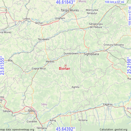
Biertan GPS coordinates[2]
46° 7' 59.988" North, 24° 31' 0.012" East
| Map corner | latitude | longitude |
|---|---|---|
| Upper-left | 46.61843°, | 23.81355° |
| Center: | 46.13333°, | 24.51667° |
| Lower-right: | 45.64392°, | 25.2198° |
| Map W x H: | 108.4×108.4 km | = 67.4×67.4mi |
| max Lat: | 48.23793° ⇑42% North |
| Biertan: | 46.13333° |
| min Lat: | ⇓58% South 43.65638° |
| min Long | Biertan | max Long |
| 20.31667° | 24.51667° | 29.65403° |
| W 39.8%⇐ | ⇒60.2% E |
Elevation
Elevation of Biertan is 380 m = 1247 ft, and this is 125.1 m = 410 ft above average elevation for this country.
| Max E: |
1278 m = 4193 ft | 21.5% |
| Biertan | 380 m 1247 ft | |
| Avg. | 254.9 m = 836 ft | |
Min E: |
-2 m = -7 ft | 78.5% |
See also: Romania elevation on elevation.city.
Geographical zone
Biertan is located in North temperate zone (between Tropic of Cancer and the Arctic Circle). Distance of this North polar circle is 2271.6 km =1411.5 mi to North.| Distance of | km | miles | from Biertan |
|---|---|---|---|
| North Pole | 4877.5 | 3030.7 | to North |
| Arctic Circle | 2271.6 | 1411.5 | to North |
| Tropic Cancer | 2523.6 | 1568.1 | to South |
| Equator | 5129.5 | 3187.3 | to South |


Nearby cities:
15 places around Biertan: (largest is in red/bold)
• Alma
9.4 km =5.8 mi,  342°
342°
• Aţel
4.3 km =2.7 mi,  295°
295°
• Brateiu
8.5 km =5.3 mi, 295°
• Buzd
7.8 km =4.8 mi,  273°
273°
• Dumbrăveni
11.8 km =7.3 mi,  19°
19°
• Dârlos
10.6 km =6.6 mi, 301°
• Ighișu Nou
13.1 km =8.1 mi,  259°
259°
• Mediaş
13.4 km =8.3 mi,  286°
286°
• Moşna
10.6 km =6.6 mi,  238°
238°
• Mălâncrav
10.5 km =6.5 mi,  104°
104°
• Nemșa
7.6 km =4.7 mi,  226°
226°
• Richiș
4.8 km =3 mi,  214°
214°
• Valchid
6.5 km =4 mi,  51°
51°
• Șaroș pe Târnave
7.8 km =4.8 mi, 19°
• Șmig
11.6 km =7.2 mi,  331°
331°
Sources, notices
• [Note1] Compared only with cities in Romania existing in our database
• [Src1] Map data: © OpenStreetMap contributors (CC-BY-SA)
• [Src2] Other city data from geonames.org with taken over terms of usage.
• [Src3] Geographical zone / Annual Mean Temperature by Robert A. Rohde @ Wikipedia
