Șaroș pe Târnave geodata
Șaroș pe Târnave (Sibiu) is a populated place; located in Romania in Europe/Bucharest (GMT+3) time zone. With population of 1,640 people, there are 2992 cities with bigger population in this country. Compared to other cities in Romania, 59.5% of cities are located further ↓South; 59.6% of cities are located further →East and 81.4% of cities have lower elevation than Șaroș pe Târnave. Note1


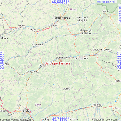
Șaroș pe Târnave GPS coordinates[2]
46° 12' 0" North, 24° 33' 0" East
| Map corner | latitude | longitude |
|---|---|---|
| Upper-left | 46.68451°, | 23.84688° |
| Center: | 46.2°, | 24.55° |
| Lower-right: | 45.71118°, | 25.25313° |
| Map W x H: | 108.2×108.2 km | = 67.2×67.2mi |
| max Lat: | 48.23793° ⇑40.5% North |
| Șaroș pe Târnave: | 46.2° |
| min Lat: | ⇓59.5% South 43.65638° |
| min Long | Șaroș pe Târ | max Long |
| 20.31667° | 24.55° | 29.65403° |
| W 40.4%⇐ | ⇒59.6% E |
Elevation
Elevation of Șaroș pe Târnave is 407 m = 1335 ft, and this is 152.1 m = 499 ft above average elevation for this country.
| Max E: |
1278 m = 4193 ft | 18.6% |
| Șaroș pe Târnave | 407 m 1335 ft | |
| Avg. | 254.9 m = 836 ft | |
Min E: |
-2 m = -7 ft | 81.4% |
See also: Romania elevation on elevation.city.
Geographical zone
Șaroș pe Târnave is located in North temperate zone (between Tropic of Cancer and the Arctic Circle). Distance of this North polar circle is 2264.2 km =1406.9 mi to North.| Distance of | km | miles | from Șaroș pe Târnave |
|---|---|---|---|
| North Pole | 4870.1 | 3026.1 | to North |
| Arctic Circle | 2264.2 | 1406.9 | to North |
| Tropic Cancer | 2531 | 1572.7 | to South |
| Equator | 5137 | 3192 | to South |


Nearby cities:
15 places around Șaroș pe Târnave: (largest is in red/bold)
• Alma
5.6 km =3.5 mi,  285°
285°
• Aţel
8.5 km =5.3 mi,  229°
229°
• Biertan
7.8 km =4.8 mi,  199°
199°
• Brateiu
10.9 km =6.8 mi,  250°
250°
• Curciu
12 km =7.5 mi, 294°
• Daneş
11.7 km =7.3 mi,  80°
80°
• Dumbrăveni
3.9 km =2.4 mi,  19°
19°
• Dârlos
11.7 km =7.3 mi,  260°
260°
• Gogan
11.9 km =7.4 mi,  347°
347°
• Hoghilag
6.3 km =3.9 mi,  54°
54°
• Laslea
7.9 km =4.9 mi, 76°
• Sântioana
9.3 km =5.8 mi,  0°
0°
• Valchid
4.2 km =2.6 mi,  142°
142°
• Viişoara
10 km =6.2 mi, 22°
• Șmig
8.5 km =5.3 mi, 289°
Sources, notices
• [Note1] Compared only with cities in Romania existing in our database
• [Src1] Map data: © OpenStreetMap contributors (CC-BY-SA)
• [Src2] Other city data from geonames.org with taken over terms of usage.
• [Src3] Geographical zone / Annual Mean Temperature by Robert A. Rohde @ Wikipedia
