Bâcleș geodata
Bâcleș (Mehedinţi) is a seat of a second-order administrative division; located in Romania in Europe/Bucharest (GMT+3) time zone. With population of 442 people, there are 7032 cities with bigger population in this country. Compared to other cities in Romania, 85.7% of cities are located further ↑North; 82.6% of cities are located further →East and 56.7% of cities have lower elevation than Bâcleș. Note1


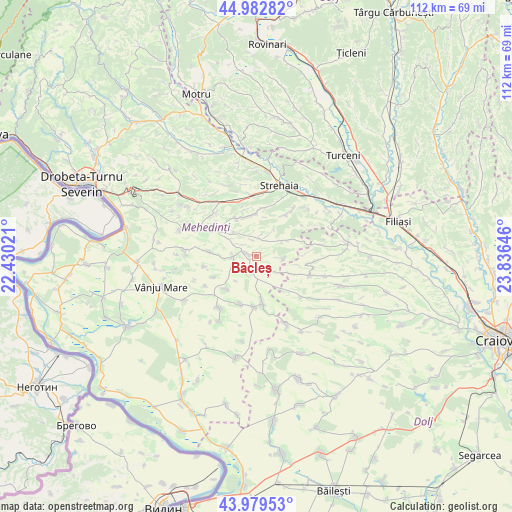
Bâcleș GPS coordinates[2]
44° 28' 59.988" North, 23° 7' 59.988" East
| Map corner | latitude | longitude |
|---|---|---|
| Upper-left | 44.98282°, | 22.43021° |
| Center: | 44.48333°, | 23.13333° |
| Lower-right: | 43.97953°, | 23.83646° |
| Map W x H: | 111.6×111.6 km | = 69.3×69.3mi |
| max Lat: | 48.23793° ⇑85.7% North |
| Bâcleș: | 44.48333° |
| min Lat: | ⇓14.3% South 43.65638° |
| min Long | Bâcleș | max Long |
| 20.31667° | 23.13333° | 29.65403° |
| W 17.4%⇐ | ⇒82.6% E |
Elevation
Elevation of Bâcleș is 246 m = 807 ft, and this is 8.9 m = 29 ft below average elevation for this country.
| Max E: |
1278 m = 4193 ft | 43.3% |
| Avg. | 254.9 m = 836 ft | |
| Bâcleș | 246 m = 807 ft | |
Min E: |
-2 m = -7 ft | 56.7% |
See also: Romania elevation on elevation.city.
Geographical zone
Bâcleș is located in North temperate zone (between Tropic of Cancer and the Arctic Circle). Distance of this Northern Tropic circle is 2340.2 km =1454.1 mi to South.| Distance of | km | miles | from Bâcleș |
|---|---|---|---|
| North Pole | 5061 | 3144.8 | to North |
| Arctic Circle | 2455.1 | 1525.5 | to North |
| Tropic Cancer | 2340.2 | 1454.1 | to South |
| Equator | 4946.1 | 3073.4 | to South |


Nearby cities:
15 places around Bâcleș: (largest is in red/bold)
• Albulești
6.7 km =4.2 mi,  57°
57°
• Brezniţa-Motru
11.4 km =7.1 mi,  35°
35°
• Busu
8.2 km =5.1 mi,  116°
116°
• Bălăciţa
11.1 km =6.9 mi,  180°
180°
• Corzu
4.3 km =2.7 mi,  138°
138°
• Dobra
10.8 km =6.7 mi,  198°
198°
• Dumbrava de Sus
3.9 km =2.4 mi,  340°
340°
• Greceşti
12.5 km =7.8 mi,  107°
107°
• Greci
7.5 km =4.7 mi,  349°
349°
• Gvardinița
9.9 km =6.2 mi,  173°
173°
• Iablanița
11.7 km =7.3 mi,  259°
259°
• Padina Mică
12.8 km =8 mi,  240°
240°
• Slașoma
9.7 km =6 mi,  223°
223°
• Smadovița
5.4 km =3.4 mi,  93°
93°
• Stignița
10.5 km =6.5 mi,  275°
275°
Sources, notices
• [Note1] Compared only with cities in Romania existing in our database
• [Src1] Map data: © OpenStreetMap contributors (CC-BY-SA)
• [Src2] Other city data from geonames.org with taken over terms of usage.
• [Src3] Geographical zone / Annual Mean Temperature by Robert A. Rohde @ Wikipedia
