Iablanița geodata
Iablanița (Mehedinţi) is a populated place; located in Romania in Europe/Bucharest (GMT+3) time zone. With population of 539 people, there are 6689 cities with bigger population in this country. Compared to other cities in Romania, 86.2% of cities are located further ↑North; 84.5% of cities are located further →East and 63.2% of cities have lower elevation than Iablanița. Note1


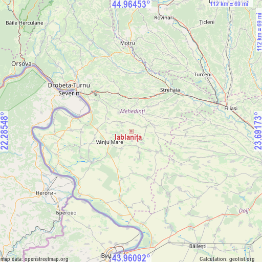
Iablanița GPS coordinates[2]
44° 27' 53.568" North, 22° 59' 18.96" East
| Map corner | latitude | longitude |
|---|---|---|
| Upper-left | 44.96453°, | 22.28548° |
| Center: | 44.46488°, | 22.9886° |
| Lower-right: | 43.96092°, | 23.69173° |
| Map W x H: | 111.6×111.6 km | = 69.3×69.3mi |
| max Lat: | 48.23793° ⇑86.2% North |
| Iablanița: | 44.46488° |
| min Lat: | ⇓13.8% South 43.65638° |
| min Long | Iablanița | max Long |
| 20.31667° | 22.9886° | 29.65403° |
| W 15.5%⇐ | ⇒84.5% E |
Elevation
Elevation of Iablanița is 280 m = 919 ft, and this is 25.1 m = 82 ft above average elevation for this country.
| Max E: |
1278 m = 4193 ft | 36.8% |
| Iablanița | 280 m 919 ft | |
| Avg. | 254.9 m = 836 ft | |
Min E: |
-2 m = -7 ft | 63.2% |
See also: Romania elevation on elevation.city.
Geographical zone
Iablanița is located in North temperate zone (between Tropic of Cancer and the Arctic Circle). Distance of this Northern Tropic circle is 2338.1 km =1452.8 mi to South.| Distance of | km | miles | from Iablanița |
|---|---|---|---|
| North Pole | 5063 | 3146 | to North |
| Arctic Circle | 2457.1 | 1526.8 | to North |
| Tropic Cancer | 2338.1 | 1452.8 | to South |
| Equator | 4944 | 3072.1 | to South |


Nearby cities:
15 places around Iablanița: (largest is in red/bold)
• Almăjel
9.7 km =6 mi,  160°
160°
• Bâcleș
11.7 km =7.3 mi,  79°
79°
• Corlăţel
8.6 km =5.3 mi,  210°
210°
• Dobra
11.5 km =7.1 mi,  135°
135°
• Dumbrava de Sus
11.7 km =7.3 mi,  60°
60°
• Livezile
11.2 km =7 mi,  297°
297°
• Orevița Mare
6 km =3.7 mi,  261°
261°
• Padina Mică
4.2 km =2.6 mi,  175°
175°
• Poroina Mare
5.3 km =3.3 mi,  309°
309°
• Slașoma
7 km =4.3 mi, 135°
• Stignița
3.3 km =2.1 mi,  17°
17°
• Traian
10.4 km =6.5 mi,  266°
266°
• Tâmna
11.5 km =7.1 mi,  11°
11°
• Valea Anilor
12.3 km =7.6 mi, 205°
• Vânju-Mare
10.4 km =6.5 mi,  244°
244°
Sources, notices
• [Note1] Compared only with cities in Romania existing in our database
• [Src1] Map data: © OpenStreetMap contributors (CC-BY-SA)
• [Src2] Other city data from geonames.org with taken over terms of usage.
• [Src3] Geographical zone / Annual Mean Temperature by Robert A. Rohde @ Wikipedia
