Sviniţa geodata
Sviniţa (Mehedinţi) is a seat of a second-order administrative division; located in Romania in Europe/Bucharest (GMT+3) time zone. With population of 1,105 people, there are 3977 cities with bigger population in this country. Compared to other cities in Romania, 85.2% of cities are located further ↑North; 93.6% of cities are located further →East and 55.8% of cities have higher elevation than Sviniţa. Note1


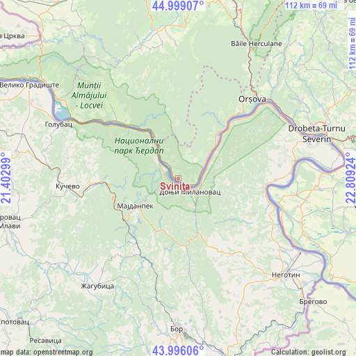
Sviniţa GPS coordinates[2]
44° 29' 58.992" North, 22° 6' 21.996" East
| Map corner | latitude | longitude |
|---|---|---|
| Upper-left | 44.99907°, | 21.40299° |
| Center: | 44.49972°, | 22.10611° |
| Lower-right: | 43.99606°, | 22.80924° |
| Map W x H: | 111.5×111.5 km | = 69.3×69.3mi |
| max Lat: | 48.23793° ⇑85.2% North |
| Sviniţa: | 44.49972° |
| min Lat: | ⇓14.8% South 43.65638° |
| min Long | Sviniţa | max Long |
| 20.31667° | 22.10611° | 29.65403° |
| W 6.4%⇐ | ⇒93.6% E |
Elevation
Elevation of Sviniţa is 183 m = 600 ft, and this is 71.9 m = 236 ft below average elevation for this country.
| Max E: |
1278 m = 4193 ft | 55.8% |
| Avg. | 254.9 m = 836 ft | |
| Sviniţa | 183 m = 600 ft | |
Min E: |
-2 m = -7 ft | 44.2% |
See also: Romania elevation on elevation.city.
Geographical zone
Sviniţa is located in North temperate zone (between Tropic of Cancer and the Arctic Circle). Distance of this Northern Tropic circle is 2342 km =1455.3 mi to South.| Distance of | km | miles | from Sviniţa |
|---|---|---|---|
| North Pole | 5059.2 | 3143.6 | to North |
| Arctic Circle | 2453.3 | 1524.4 | to North |
| Tropic Cancer | 2342 | 1455.3 | to South |
| Equator | 4947.9 | 3074.5 | to South |


Nearby cities:
15 places around Sviniţa: (largest is in red/bold)
• Berzasca
20.3 km =12.6 mi,  323°
323°
• Burila Mare
37.5 km =23.3 mi,  98°
98°
• Burila Mică
39.1 km =24.3 mi, 103°
• Coronini
38.9 km =24.2 mi,  301°
301°
• Crivina
37 km =23 mi,  88°
88°
• Dubova
18.2 km =11.3 mi,  44°
44°
• Eşelniţa
30 km =18.6 mi, 42°
• Gornea
28.2 km =17.5 mi, 315°
• Gura Văii
40.2 km =25 mi,  62°
62°
• Liubcova
24.3 km =15.1 mi, 316°
• Orşova
33.8 km =21 mi, 42°
• Ostrovu Mare
35.2 km =21.9 mi,  112°
112°
• Sfânta Elena
36.9 km =22.9 mi, 302°
• Sicheviţa
33.2 km =20.6 mi, 322°
• Topleţ
40.2 km =25 mi,  34°
34°
Sources, notices
• [Note1] Compared only with cities in Romania existing in our database
• [Src1] Map data: © OpenStreetMap contributors (CC-BY-SA)
• [Src2] Other city data from geonames.org with taken over terms of usage.
• [Src3] Geographical zone / Annual Mean Temperature by Robert A. Rohde @ Wikipedia
