Băcani geodata
Băcani (Vaslui) is a seat of a second-order administrative division; located in Romania in Europe/Bucharest (GMT+3) time zone. With population of 2,748 people, there are 1946 cities with bigger population in this country. Compared to other cities in Romania, 62.9% of cities are located further ↓South; 92.8% of cities are located further ←West and 62% of cities have higher elevation than Băcani. Note1


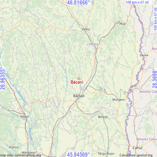
Băcani GPS coordinates[2]
46° 19' 59.988" North, 27° 40' 0.012" East
| Map corner | latitude | longitude |
|---|---|---|
| Upper-left | 46.81666°, | 26.96355° |
| Center: | 46.33333°, | 27.66667° |
| Lower-right: | 45.84569°, | 28.3698° |
| Map W x H: | 108×108 km | = 67.1×67.1mi |
| max Lat: | 48.23793° ⇑37.1% North |
| Băcani: | 46.33333° |
| min Lat: | ⇓62.9% South 43.65638° |
| min Long | Băcani | max Long |
| 20.31667° | 27.66667° | 29.65403° |
| W 92.8%⇐ | ⇒7.2% E |
Elevation
Elevation of Băcani is 159 m = 522 ft, and this is 95.9 m = 315 ft below average elevation for this country.
| Max E: |
1278 m = 4193 ft | 62% |
| Avg. | 254.9 m = 836 ft | |
| Băcani | 159 m = 522 ft | |
Min E: |
-2 m = -7 ft | 38% |
See also: Romania elevation on elevation.city.
Geographical zone
Băcani is located in North temperate zone (between Tropic of Cancer and the Arctic Circle). Distance of this North polar circle is 2249.4 km =1397.7 mi to North.| Distance of | km | miles | from Băcani |
|---|---|---|---|
| North Pole | 4855.3 | 3016.9 | to North |
| Arctic Circle | 2249.4 | 1397.7 | to North |
| Tropic Cancer | 2545.9 | 1581.9 | to South |
| Equator | 5151.8 | 3201.2 | to South |


Nearby cities:
15 places around Băcani: (largest is in red/bold)
• Alexandru Vlăhuţă
9.6 km =6 mi,  344°
344°
• Banca
10.9 km =6.8 mi,  109°
109°
• Bogești
8.9 km =5.5 mi,  276°
276°
• Bârlad
11.3 km =7 mi,  179°
179°
• Gara Banca
9.8 km =6.1 mi,  86°
86°
• Hălărești
10.9 km =6.8 mi,  308°
308°
• Iana
10.5 km =6.5 mi,  301°
301°
• Ibănești
7.5 km =4.7 mi, 335°
• Măscurei
10.9 km =6.8 mi,  274°
274°
• Perieni
5.3 km =3.3 mi,  226°
226°
• Pogana
7.9 km =4.9 mi,  256°
256°
• Simila
8.2 km =5.1 mi,  161°
161°
• Tomești
6.8 km =4.2 mi,  291°
291°
• Unțești
8.7 km =5.4 mi,  35°
35°
• Zorleni
8.3 km =5.2 mi,  152°
152°
Sources, notices
• [Note1] Compared only with cities in Romania existing in our database
• [Src1] Map data: © OpenStreetMap contributors (CC-BY-SA)
• [Src2] Other city data from geonames.org with taken over terms of usage.
• [Src3] Geographical zone / Annual Mean Temperature by Robert A. Rohde @ Wikipedia
