Albeşti geodata
Albeşti (Mureş) is a seat of a second-order administrative division; located in Romania in Europe/Bucharest (GMT+3) time zone. With population of 5,382 people, there are 668 cities with bigger population in this country. Compared to other cities in Romania, 60.4% of cities are located further ↓South; 54.8% of cities are located further →East and 76.9% of cities have lower elevation than Albeşti. Note1


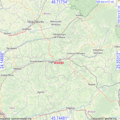
Albeşti GPS coordinates[2]
46° 13' 59.988" North, 24° 51' 0" East
| Map corner | latitude | longitude |
|---|---|---|
| Upper-left | 46.71754°, | 24.14688° |
| Center: | 46.23333°, | 24.85° |
| Lower-right: | 45.74481°, | 25.55313° |
| Map W x H: | 108.2×108.2 km | = 67.2×67.2mi |
| max Lat: | 48.23793° ⇑39.6% North |
| Albeşti: | 46.23333° |
| min Lat: | ⇓60.4% South 43.65638° |
| min Long | Albeşti | max Long |
| 20.31667° | 24.85° | 29.65403° |
| W 45.2%⇐ | ⇒54.8% E |
Elevation
Elevation of Albeşti is 367 m = 1204 ft, and this is 112.1 m = 368 ft above average elevation for this country.
| Max E: |
1278 m = 4193 ft | 23.1% |
| Albeşti | 367 m 1204 ft | |
| Avg. | 254.9 m = 836 ft | |
Min E: |
-2 m = -7 ft | 76.9% |
See also: Romania elevation on elevation.city.
Geographical zone
Albeşti is located in North temperate zone (between Tropic of Cancer and the Arctic Circle). Distance of this North polar circle is 2260.5 km =1404.6 mi to North.| Distance of | km | miles | from Albeşti |
|---|---|---|---|
| North Pole | 4866.4 | 3023.8 | to North |
| Arctic Circle | 2260.5 | 1404.6 | to North |
| Tropic Cancer | 2534.7 | 1575 | to South |
| Equator | 5140.7 | 3194.3 | to South |


Nearby cities:
15 places around Albeşti: (largest is in red/bold)
• Bodogaia
12.2 km =7.6 mi,  67°
67°
• Boiu
4.1 km =2.5 mi,  25°
25°
• Daia
10.4 km =6.5 mi,  157°
157°
• Daneş
11.7 km =7.3 mi,  260°
260°
• Eliseni
9.4 km =5.8 mi,  45°
45°
• Hetiur
7.4 km =4.6 mi,  304°
304°
• Nadeş
12.9 km =8 mi,  315°
315°
• Saschiz
10.6 km =6.6 mi,  121°
121°
• Secuieni
10.1 km =6.3 mi, 71°
• Seleuș
12 km =7.5 mi,  274°
274°
• Sighișoara
4.6 km =2.9 mi,  253°
253°
• Săcel
9.8 km =6.1 mi,  40°
40°
• Vânători
6.4 km =4 mi,  90°
90°
• Șaeș
10.6 km =6.6 mi,  216°
216°
• Șoard
6.7 km =4.2 mi,  60°
60°
Sources, notices
• [Note1] Compared only with cities in Romania existing in our database
• [Src1] Map data: © OpenStreetMap contributors (CC-BY-SA)
• [Src2] Other city data from geonames.org with taken over terms of usage.
• [Src3] Geographical zone / Annual Mean Temperature by Robert A. Rohde @ Wikipedia
