Rumenka geodata
Rumenka (Vojvodina) is a populated place; located in Serbia in Europe/Belgrade (GMT+2) time zone. With population of 4,367 people, there are 103 cities with bigger population in this country. Compared to other cities in Serbia, 76.2% of cities are located further ↓South; 75.5% of cities are located further →East and 60.1% of cities have higher elevation than Rumenka. Note1


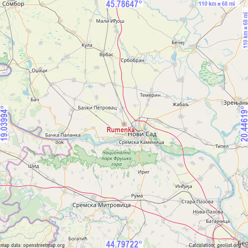
Rumenka GPS coordinates[2]
45° 17' 38.4" North, 19° 44' 35.016" East
| Map corner | latitude | longitude |
|---|---|---|
| Upper-left | 45.78647°, | 19.03994° |
| Center: | 45.294°, | 19.74306° |
| Lower-right: | 44.79722°, | 20.44619° |
| Map W x H: | 110×110 km | = 68.4×68.4mi |
| max Lat: | 46.1° ⇑23.8% North |
| Rumenka: | 45.294° |
| min Lat: | ⇓76.2% South 42.25846° |
| min Long | Rumenka | max Long |
| 18.9276° | 19.74306° | 22.77556° |
| W 24.5%⇐ | ⇒75.5% E |
Elevation
Elevation of Rumenka is 82 m = 269 ft, and this is 94.4 m = 310 ft below average elevation for this country.
| Max E: |
1421 m = 4662 ft | 60.1% |
| Avg. | 176.4 m = 579 ft | |
| Rumenka | 82 m = 269 ft | |
Min E: |
49 m = 161 ft | 39.9% |
See also: Serbia elevation on elevation.city.
Geographical zone
Rumenka is located in North temperate zone (between Tropic of Cancer and the Arctic Circle). Distance of this North polar circle is 2365 km =1469.5 mi to North.| Distance of | km | miles | from Rumenka |
|---|---|---|---|
| North Pole | 4970.8 | 3088.7 | to North |
| Arctic Circle | 2365 | 1469.5 | to North |
| Tropic Cancer | 2430.3 | 1510.1 | to South |
| Equator | 5036.2 | 3129.3 | to South |


Nearby cities:
15 places around Rumenka: (largest is in red/bold)
• Bački Petrovac
14 km =8.7 mi,  302°
302°
• Beočin
9.7 km =6 mi,  190°
190°
• Gložan
13.8 km =8.6 mi,  263°
263°
• Kisač
6.8 km =4.2 mi,  351°
351°
• Kulpin
17.1 km =10.6 mi,  314°
314°
• Maglić
18.2 km =11.3 mi,  294°
294°
• Novi Sad
8.7 km =5.4 mi,  122°
122°
• Petrovaradin
11.9 km =7.4 mi, 116°
• Sremski Karlovci
18 km =11.2 mi, 124°
• Stepanovićevo
13.7 km =8.5 mi, 345°
• Temerin
17.1 km =10.6 mi,  41°
41°
• Veternik
4.6 km =2.9 mi,  164°
164°
• Vrdnik
19.5 km =12.1 mi,  168°
168°
• Zmajevo
18.3 km =11.4 mi, 347°
• Čelarevo
17.3 km =10.7 mi, 261°
Sources, notices
• [Note1] Compared only with cities in Serbia existing in our database
• [Src1] Map data: © OpenStreetMap contributors (CC-BY-SA)
• [Src2] Other city data from geonames.org with taken over terms of usage.
• [Src3] Geographical zone / Annual Mean Temperature by Robert A. Rohde @ Wikipedia
