Banovo Polje geodata
Banovo Polje (Central Serbia) is a populated place; located in Serbia in Europe/Belgrade (GMT+2) time zone. With population of 1,732 people, there are 236 cities with bigger population in this country. Compared to other cities in Serbia, 53.5% of cities are located further ↓South; 89.6% of cities are located further →East and 63.3% of cities have higher elevation than Banovo Polje. Note1


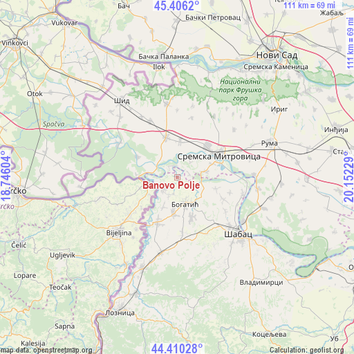
Banovo Polje GPS coordinates[2]
44° 54' 37.44" North, 19° 26' 56.976" East
| Map corner | latitude | longitude |
|---|---|---|
| Upper-left | 45.4062°, | 18.74604° |
| Center: | 44.9104°, | 19.44916° |
| Lower-right: | 44.41028°, | 20.15229° |
| Map W x H: | 110.7×110.7 km | = 68.8×68.8mi |
| max Lat: | 46.1° ⇑46.5% North |
| Banovo Polje: | 44.9104° |
| min Lat: | ⇓53.5% South 42.25846° |
| min Long | Banovo Polje | max Long |
| 18.9276° | 19.44916° | 22.77556° |
| W 10.4%⇐ | ⇒89.6% E |
Elevation
Elevation of Banovo Polje is 81 m = 266 ft, and this is 95.4 m = 313 ft below average elevation for this country.
| Max E: |
1421 m = 4662 ft | 63.3% |
| Avg. | 176.4 m = 579 ft | |
| Banovo Polje | 81 m = 266 ft | |
Min E: |
49 m = 161 ft | 36.7% |
See also: Serbia elevation on elevation.city.
Geographical zone
Banovo Polje is located in North temperate zone (between Tropic of Cancer and the Arctic Circle). Distance of this Northern Tropic circle is 2387.6 km =1483.6 mi to South.| Distance of | km | miles | from Banovo Polje |
|---|---|---|---|
| North Pole | 5013.5 | 3115.2 | to North |
| Arctic Circle | 2407.6 | 1496 | to North |
| Tropic Cancer | 2387.6 | 1483.6 | to South |
| Equator | 4993.6 | 3102.9 | to South |


Nearby cities:
15 places around Banovo Polje: (largest is in red/bold)
• Belotić
12.9 km =8 mi,  142°
142°
• Bogatić
8.5 km =5.3 mi,  163°
163°
• Bosut
7.3 km =4.5 mi,  287°
287°
• Crna Bara
5.9 km =3.7 mi,  226°
226°
• Glogovac
5.9 km =3.7 mi,  207°
207°
• Glušci
8.2 km =5.1 mi,  105°
105°
• Klenje
11.4 km =7.1 mi,  185°
185°
• Metković
9.8 km =6.1 mi,  128°
128°
• Radenković
3.9 km =2.4 mi,  70°
70°
• Ravnje
4.2 km =2.6 mi,  330°
330°
• Salaš Crnobarski
10.1 km =6.3 mi, 205°
• Salaš Noćajski
11.5 km =7.1 mi, 69°
• Sremska Rača
12.9 km =8 mi,  275°
275°
• Uzveće
12.7 km =7.9 mi, 106°
• Zasavica Prva
5.8 km =3.6 mi,  32°
32°
Sources, notices
• [Note1] Compared only with cities in Serbia existing in our database
• [Src1] Map data: © OpenStreetMap contributors (CC-BY-SA)
• [Src2] Other city data from geonames.org with taken over terms of usage.
• [Src3] Geographical zone / Annual Mean Temperature by Robert A. Rohde @ Wikipedia
