Bogatić geodata
Bogatić (Central Serbia) is a seat of a third-order administrative division; located in Serbia in Europe/Belgrade (GMT+2) time zone. With population of 7,225 people, there are 69 cities with bigger population in this country. Compared to other cities in Serbia, 50.6% of cities are located further ↑North; 88.9% of cities are located further →East and 56.5% of cities have higher elevation than Bogatić. Note1


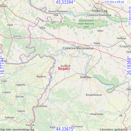
Bogatić GPS coordinates[2]
44° 50' 15" North, 19° 28' 50.016" East
| Map corner | latitude | longitude |
|---|---|---|
| Upper-left | 45.33394°, | 18.77744° |
| Center: | 44.8375°, | 19.48056° |
| Lower-right: | 44.33675°, | 20.18369° |
| Map W x H: | 110.9×110.9 km | = 68.9×68.9mi |
| max Lat: | 46.1° ⇑50.6% North |
| Bogatić: | 44.8375° |
| min Lat: | ⇓49.4% South 42.25846° |
| min Long | Bogatić | max Long |
| 18.9276° | 19.48056° | 22.77556° |
| W 11.1%⇐ | ⇒88.9% E |
Elevation
Elevation of Bogatić is 84 m = 276 ft, and this is 92.4 m = 303 ft below average elevation for this country.
| Max E: |
1421 m = 4662 ft | 56.5% |
| Avg. | 176.4 m = 579 ft | |
| Bogatić | 84 m = 276 ft | |
Min E: |
49 m = 161 ft | 43.5% |
See also: Serbia elevation on elevation.city.
Geographical zone
Bogatić is located in North temperate zone (between Tropic of Cancer and the Arctic Circle). Distance of this Northern Tropic circle is 2379.5 km =1478.6 mi to South.| Distance of | km | miles | from Bogatić |
|---|---|---|---|
| North Pole | 5021.6 | 3120.3 | to North |
| Arctic Circle | 2415.7 | 1501 | to North |
| Tropic Cancer | 2379.5 | 1478.6 | to South |
| Equator | 4985.5 | 3097.8 | to South |


Nearby cities:
15 places around Bogatić: (largest is in red/bold)
• Badovinci
10.4 km =6.5 mi,  236°
236°
• Banovo Polje
8.5 km =5.3 mi,  343°
343°
• Belotić
5.8 km =3.6 mi,  112°
112°
• Crna Bara
7.9 km =4.9 mi,  300°
300°
• Dublje
4.6 km =2.9 mi,  150°
150°
• Glogovac
5.9 km =3.7 mi, 299°
• Glušci
8 km =5 mi,  42°
42°
• Klenje
4.9 km =3 mi,  227°
227°
• Metković
5.6 km =3.5 mi,  68°
68°
• Radenković
9.5 km =5.9 mi,  7°
7°
• Ravnje
12.6 km =7.8 mi, 338°
• Salaš Crnobarski
6.9 km =4.3 mi,  261°
261°
• Uzveće
10.7 km =6.6 mi,  64°
64°
• Zminjak
9 km =5.6 mi,  184°
184°
• Štitar
10.3 km =6.4 mi,  118°
118°
Sources, notices
• [Note1] Compared only with cities in Serbia existing in our database
• [Src1] Map data: © OpenStreetMap contributors (CC-BY-SA)
• [Src2] Other city data from geonames.org with taken over terms of usage.
• [Src3] Geographical zone / Annual Mean Temperature by Robert A. Rohde @ Wikipedia
