Ravnje geodata
Ravnje (Vojvodina) is a populated place; located in Serbia in Europe/Belgrade (GMT+2) time zone. With population of 1,692 people, there are 239 cities with bigger population in this country. Compared to other cities in Serbia, 54.9% of cities are located further ↓South; 90.7% of cities are located further →East and 67.1% of cities have higher elevation than Ravnje. Note1


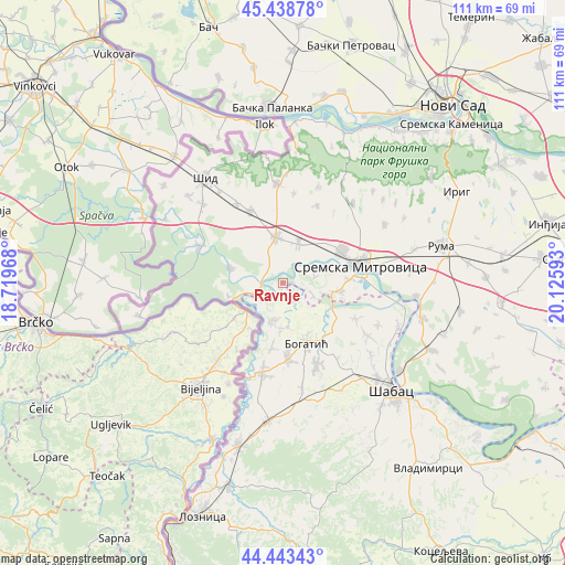
Ravnje GPS coordinates[2]
44° 56' 35.736" North, 19° 25' 22.08" East
| Map corner | latitude | longitude |
|---|---|---|
| Upper-left | 45.43878°, | 18.71968° |
| Center: | 44.94326°, | 19.4228° |
| Lower-right: | 44.44343°, | 20.12593° |
| Map W x H: | 110.7×110.7 km | = 68.8×68.8mi |
| max Lat: | 46.1° ⇑45.1% North |
| Ravnje: | 44.94326° |
| min Lat: | ⇓54.9% South 42.25846° |
| min Long | Ravnje | max Long |
| 18.9276° | 19.4228° | 22.77556° |
| W 9.3%⇐ | ⇒90.7% E |
Elevation
Elevation of Ravnje is 80 m = 262 ft, and this is 96.4 m = 316 ft below average elevation for this country.
| Max E: |
1421 m = 4662 ft | 67.1% |
| Avg. | 176.4 m = 579 ft | |
| Ravnje | 80 m = 262 ft | |
Min E: |
49 m = 161 ft | 32.9% |
See also: Serbia elevation on elevation.city.
Geographical zone
Ravnje is located in North temperate zone (between Tropic of Cancer and the Arctic Circle). Distance of this Northern Tropic circle is 2391.3 km =1485.9 mi to South.| Distance of | km | miles | from Ravnje |
|---|---|---|---|
| North Pole | 5009.8 | 3112.9 | to North |
| Arctic Circle | 2404 | 1493.8 | to North |
| Tropic Cancer | 2391.3 | 1485.9 | to South |
| Equator | 4997.2 | 3105.1 | to South |


Nearby cities:
15 places around Ravnje: (largest is in red/bold)
• Banovo Polje
4.2 km =2.6 mi,  150°
150°
• Bogatić
12.6 km =7.8 mi,  158°
158°
• Bosut
5.1 km =3.2 mi,  252°
252°
• Crna Bara
8 km =5 mi,  195°
195°
• Glogovac
8.9 km =5.5 mi,  183°
183°
• Glušci
11.6 km =7.2 mi,  120°
120°
• Klenje
15.1 km =9.4 mi, 176°
• Mačvanska Mitrovica
13.7 km =8.5 mi,  78°
78°
• Metković
13.7 km =8.5 mi,  134°
134°
• Radenković
6.2 km =3.9 mi,  112°
112°
• Salaš Crnobarski
13 km =8.1 mi,  189°
189°
• Salaš Noćajski
12.9 km =8 mi,  88°
88°
• Sremska Rača
11.1 km =6.9 mi,  256°
256°
• Višnjićevo
10.8 km =6.7 mi,  284°
284°
• Zasavica Prva
5.4 km =3.4 mi, 76°
Sources, notices
• [Note1] Compared only with cities in Serbia existing in our database
• [Src1] Map data: © OpenStreetMap contributors (CC-BY-SA)
• [Src2] Other city data from geonames.org with taken over terms of usage.
• [Src3] Geographical zone / Annual Mean Temperature by Robert A. Rohde @ Wikipedia
