Pančevo geodata
Pančevo (Vojvodina) is a seat of a second-order administrative division; located in Serbia in Europe/Belgrade (GMT+2) time zone. With population of 76,654 people, there are 11 cities with bigger population in this country. Compared to other cities in Serbia, 51% of cities are located further ↓South; 65.5% of cities are located further ←West and 67.1% of cities have higher elevation than Pančevo. Note1


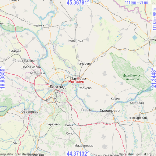
Pančevo GPS coordinates[2]
44° 52' 18.372" North, 20° 38' 30.012" East
| Map corner | latitude | longitude |
|---|---|---|
| Upper-left | 45.36791°, | 19.93855° |
| Center: | 44.87177°, | 20.64167° |
| Lower-right: | 44.37132°, | 21.3448° |
| Map W x H: | 110.8×110.8 km | = 68.8×68.8mi |
| max Lat: | 46.1° ⇑49% North |
| Pančevo: | 44.87177° |
| min Lat: | ⇓51% South 42.25846° |
| min Long | Pančevo | max Long |
| 18.9276° | 20.64167° | 22.77556° |
| W 65.5%⇐ | ⇒34.5% E |
Elevation
Elevation of Pančevo is 80 m = 262 ft, and this is 96.4 m = 316 ft below average elevation for this country.
| Max E: |
1421 m = 4662 ft | 67.1% |
| Avg. | 176.4 m = 579 ft | |
| Pančevo | 80 m = 262 ft | |
Min E: |
49 m = 161 ft | 32.9% |
See also: Pančevo elevation on elevation.city.
Geographical zone
Pančevo is located in North temperate zone (between Tropic of Cancer and the Arctic Circle). Distance of this Northern Tropic circle is 2383.4 km =1481 mi to South.| Distance of | km | miles | from Pančevo |
|---|---|---|---|
| North Pole | 5017.8 | 3117.9 | to North |
| Arctic Circle | 2411.9 | 1498.7 | to North |
| Tropic Cancer | 2383.4 | 1481 | to South |
| Equator | 4989.3 | 3100.2 | to South |


Nearby cities:
15 places around Pančevo: (largest is in red/bold)
• Belgrade
15.8 km =9.8 mi,  241°
241°
• Crepaja
15.4 km =9.6 mi,  358°
358°
• Debeljača
22.3 km =13.9 mi,  351°
351°
• Novi Beograd
18.7 km =11.6 mi,  246°
246°
• Ovča
8.6 km =5.3 mi,  278°
278°
• Palilula
11.9 km =7.4 mi, 235°
• Rakovica
21.4 km =13.3 mi,  227°
227°
• Savski Venac
18 km =11.2 mi, 235°
• Sefkerin
19.4 km =12.1 mi,  319°
319°
• Stari Grad
15.4 km =9.6 mi, 247°
• Voždovac
16.7 km =10.4 mi, 231°
• Vračar
15.8 km =9.8 mi, 236°
• Zemun
19.2 km =11.9 mi,  261°
261°
• Zvezdara
13.8 km =8.6 mi,  218°
218°
• Čukarica
20.1 km =12.5 mi, 240°
Sources, notices
• [Note1] Compared only with cities in Serbia existing in our database
• [Src1] Map data: © OpenStreetMap contributors (CC-BY-SA)
• [Src2] Other city data from geonames.org with taken over terms of usage.
• [Src3] Geographical zone / Annual Mean Temperature by Robert A. Rohde @ Wikipedia
