Ust’-Ordynskiy geodata
Ust’-Ordynskiy (Irkutsk Oblast) is a seat of a second-order administrative division; located in Russia in Asia/Irkutsk (GMT+8) time zone. With population of 14,538 people, there are 1115 cities with bigger population in this country. Compared to other cities in Russia, 64% of cities are located further ↑North; 89.7% of cities are located further ←West and 92.1% of cities have lower elevation than Ust’-Ordynskiy. Note1


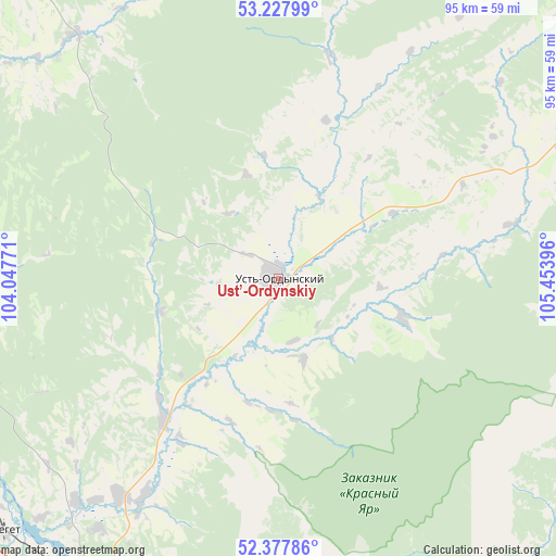
Ust’-Ordynskiy GPS coordinates[2]
52° 48' 18" North, 104° 45' 2.988" East
| Map corner | latitude | longitude |
|---|---|---|
| Upper-left | 53.22799°, | 104.04771° |
| Center: | 52.805°, | 104.75083° |
| Lower-right: | 52.37786°, | 105.45396° |
| Map W x H: | 94.5×94.5 km | = 58.7×58.7mi |
| max Lat: | 73.50819° ⇑64% North |
| Ust’-Ordynskiy: | 52.805° |
| min Lat: | ⇓36% South 41.28413° |
| min Long | Ust’-Ordynski | max Long |
| -179.12198° | 104.75083° | 179.35046° |
| W 89.7%⇐ | ⇒10.3% E |
Elevation
Elevation of Ust’-Ordynskiy is 510 m = 1673 ft, and this is 307.4 m = 1009 ft above average elevation for this country.
| Max E: |
2518 m = 8261 ft | 7.9% |
| Ust’-Ordynskiy | 510 m 1673 ft | |
| Avg. | 202.6 m = 665 ft | |
Min E: |
-28 m = -92 ft | 92.1% |
See also: Russia elevation on elevation.city.
Geographical zone
Ust’-Ordynskiy is located in North temperate zone (between Tropic of Cancer and the Arctic Circle). Distance of this North polar circle is 1529.8 km =950.6 mi to North.| Distance of | km | miles | from Ust’-Ordynskiy |
|---|---|---|---|
| North Pole | 4135.7 | 2569.8 | to North |
| Arctic Circle | 1529.8 | 950.6 | to North |
| Tropic Cancer | 3265.4 | 2029 | to South |
| Equator | 5871.4 | 3648.3 | to South |


Nearby cities:
15 places around Ust’-Ordynskiy: (largest is in red/bold)
• Angarsk
65.5 km =40.7 mi,  242°
242°
• Bayanday
58.8 km =36.5 mi,  60°
60°
• Dzerzhinsk
63.3 km =39.3 mi,  202°
202°
• Irkutsk
64.2 km =39.9 mi,  208°
208°
• Khomutovo
44.4 km =27.6 mi, 211°
• Kitoy
61.7 km =38.3 mi,  248°
248°
• Markova
75.7 km =47 mi, 208°
• Meget
64.2 km =39.9 mi,  227°
227°
• Novolisikha
67.1 km =41.7 mi, 197°
• Oyëk
31.4 km =19.5 mi,  219°
219°
• Pivovarikha
62.9 km =39.1 mi, 199°
• Smolenshchina
74.2 km =46.1 mi, 214°
• Tel’ma
70.8 km =44 mi,  260°
260°
• Urik
51.5 km =32 mi, 221°
• Usol’ye-Sibirskoye
74.6 km =46.4 mi,  265°
265°
Sources, notices
• [Note1] Compared only with cities in Russia existing in our database
• [Src1] Map data: © OpenStreetMap contributors (CC-BY-SA)
• [Src2] Other city data from geonames.org with taken over terms of usage.
• [Src3] Geographical zone / Annual Mean Temperature by Robert A. Rohde @ Wikipedia
