Tiksi geodata
Tiksi (Sakha) is a seat of a second-order administrative division; located in Russia in Asia/Yakutsk (GMT+9) time zone. With population of 5,700 people, there are 2364 cities with bigger population in this country. Compared to other cities in Russia, 99.9% of cities are located further ↓South; 93.9% of cities are located further ←West and 80% of cities have higher elevation than Tiksi. Note1


Tiksi GPS coordinates[2]
71° 41' 24.072" North, 128° 51' 52.812" East
| Map corner | latitude | longitude |
|---|---|---|
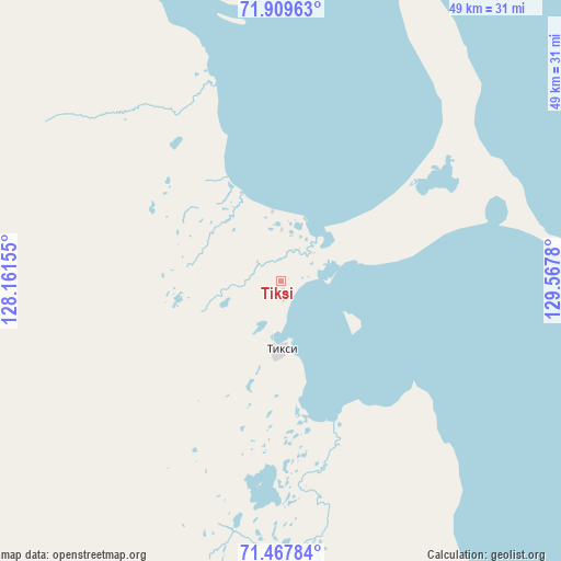
| Upper-left | 71.90963°, | 128.16155° |
| Center: | 71.69002°, | 128.86467° |
| Lower-right: | 71.46784°, | 129.5678° |
| Map W x H: | 49.1×49.1 km | = 30.5×30.5mi |
| max Lat: | 73.50819° ⇑0.1% North |
| Tiksi: | 71.69002° |
| min Lat: | ⇓99.9% South 41.28413° |
| min Long | Tiksi | max Long |
| -179.12198° | 128.86467° | 179.35046° |
| W 93.9%⇐ | ⇒6.1% E |
Elevation
Elevation of Tiksi is 71 m = 233 ft, and this is 131.6 m = 432 ft below average elevation for this country.
| Max E: |
2518 m = 8261 ft | 80% |
| Avg. | 202.6 m = 665 ft | |
| Tiksi | 71 m = 233 ft | |
Min E: |
-28 m = -92 ft | 20% |
See also: Russia elevation on elevation.city.
Geographical zone
Tiksi is located in North Frigid zone (between North Pole and Arctic Circle). Distance of this North polar circle is 570 km =354.2 mi to South.| Distance of | km | miles | from Tiksi |
|---|---|---|---|
| North Pole | 2035.9 | 1265 | to North |
| Arctic Circle | 570 | 354.2 | to South |
| Tropic Cancer | 5365.3 | 3333.8 | to South |
| Equator | 7971.2 | 4953.1 | to South |


Nearby cities:
15 places around Tiksi: (largest is in red/bold)
• Batagay
500.4 km =310.9 mi,  153°
153°
• Batagay-Alyta
436.7 km =271.4 mi,  172°
172°
• Belaya Gora
739.3 km =459.4 mi,  118°
118°
• Chokurdakh
690.8 km =429.2 mi,  99°
99°
• Deputatsky
488.9 km =303.8 mi, 122°
• Khatanga
908.1 km =564.3 mi,  272°
272°
• Kysyl-Syr
902.8 km =561 mi,  196°
196°
• Nizhneyansk
257 km =159.7 mi, 96°
• Olenyok
711.9 km =442.4 mi,  240°
240°
• Sangar
865.5 km =537.8 mi,  183°
183°
• Saskylakh
511.9 km =318.1 mi, 273°
• Udachny
872.4 km =542.1 mi,  228°
228°
• Ust-Kuyga
307.4 km =191 mi,  127°
127°
• Verkhoyansk
491.8 km =305.6 mi,  159°
159°
• Zhigansk
588.2 km =365.5 mi, 201°
Sources, notices
• [Note1] Compared only with cities in Russia existing in our database
• [Src1] Map data: © OpenStreetMap contributors (CC-BY-SA)
• [Src2] Other city data from geonames.org with taken over terms of usage.
• [Src3] Geographical zone / Annual Mean Temperature by Robert A. Rohde @ Wikipedia
