Pokosnoye geodata
Pokosnoye (Irkutsk Oblast) is a populated place; located in Russia in Asia/Irkutsk (GMT+8) time zone. With population of 3,110 people, there are 3685 cities with bigger population in this country. Compared to other cities in Russia, 58.4% of cities are located further ↓South; 88.4% of cities are located further ←West and 88.6% of cities have lower elevation than Pokosnoye. Note1


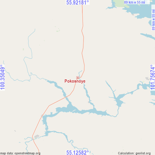
Pokosnoye GPS coordinates[2]
55° 31' 32.988" North, 101° 3' 12.996" East
| Map corner | latitude | longitude |
|---|---|---|
| Upper-left | 55.92181°, | 100.35049° |
| Center: | 55.52583°, | 101.05361° |
| Lower-right: | 55.12582°, | 101.75674° |
| Map W x H: | 88.5×88.5 km | = 55×55mi |
| max Lat: | 73.50819° ⇑41.6% North |
| Pokosnoye: | 55.52583° |
| min Lat: | ⇓58.4% South 41.28413° |
| min Long | Pokosnoye | max Long |
| -179.12198° | 101.05361° | 179.35046° |
| W 88.4%⇐ | ⇒11.6% E |
Elevation
Elevation of Pokosnoye is 413 m = 1355 ft, and this is 210.4 m = 690 ft above average elevation for this country.
| Max E: |
2518 m = 8261 ft | 11.4% |
| Pokosnoye | 413 m 1355 ft | |
| Avg. | 202.6 m = 665 ft | |
Min E: |
-28 m = -92 ft | 88.6% |
See also: Russia elevation on elevation.city.
Geographical zone
Pokosnoye is located in North temperate zone (between Tropic of Cancer and the Arctic Circle). Distance of this North polar circle is 1227.3 km =762.6 mi to North.| Distance of | km | miles | from Pokosnoye |
|---|---|---|---|
| North Pole | 3833.2 | 2381.8 | to North |
| Arctic Circle | 1227.3 | 762.6 | to North |
| Tropic Cancer | 3568 | 2217.1 | to South |
| Equator | 6173.9 | 3836.3 | to South |


Nearby cities:
15 places around Pokosnoye: (largest is in red/bold)
• Afanas’yeva
102.4 km =63.6 mi,  195°
195°
• Atagay
115.4 km =71.7 mi,  245°
245°
• Bratsk
76 km =47.2 mi,  27°
27°
• Budagovo
116.1 km =72.1 mi,  210°
210°
• Burkhun
79.3 km =49.3 mi,  190°
190°
• Chunskiy
108.1 km =67.2 mi,  304°
304°
• Guran
88.9 km =55.2 mi, 197°
• Ilir
40.8 km =25.4 mi, 214°
• Kotik
104.5 km =64.9 mi, 201°
• Lesogorsk
112.3 km =69.8 mi, 300°
• Lesogorsk
116.4 km =72.3 mi, 300°
• Sheragul
118.6 km =73.7 mi,  184°
184°
• Tselinnyye Zemli
96 km =59.7 mi, 196°
• Tulun
111.1 km =69 mi, 195°
• Vikhorevka
66.7 km =41.4 mi,  6°
6°
Sources, notices
• [Note1] Compared only with cities in Russia existing in our database
• [Src1] Map data: © OpenStreetMap contributors (CC-BY-SA)
• [Src2] Other city data from geonames.org with taken over terms of usage.
• [Src3] Geographical zone / Annual Mean Temperature by Robert A. Rohde @ Wikipedia
