Kizhinga geodata
Kizhinga (Buryatiya Republic) is a populated place; located in Russia in Asia/Irkutsk (GMT+8) time zone. With population of 6,459 people, there are 2136 cities with bigger population in this country. Compared to other cities in Russia, 70.1% of cities are located further ↑North; 91.2% of cities are located further ←West and 96.3% of cities have lower elevation than Kizhinga. Note1


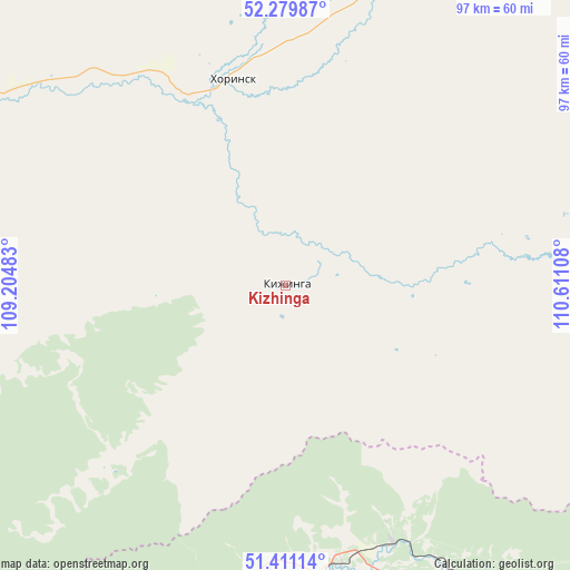
Kizhinga GPS coordinates[2]
51° 50' 51.36" North, 109° 54' 28.62" East
| Map corner | latitude | longitude |
|---|---|---|
| Upper-left | 52.27987°, | 109.20483° |
| Center: | 51.8476°, | 109.90795° |
| Lower-right: | 51.41114°, | 110.61108° |
| Map W x H: | 96.6×96.6 km | = 60×60mi |
| max Lat: | 73.50819° ⇑70.1% North |
| Kizhinga: | 51.8476° |
| min Lat: | ⇓29.9% South 41.28413° |
| min Long | Kizhinga | max Long |
| -179.12198° | 109.90795° | 179.35046° |
| W 91.2%⇐ | ⇒8.8% E |
Elevation
Elevation of Kizhinga is 718 m = 2356 ft, and this is 515.4 m = 1691 ft above average elevation for this country.
| Max E: |
2518 m = 8261 ft | 3.7% |
| Kizhinga | 718 m 2356 ft | |
| Avg. | 202.6 m = 665 ft | |
Min E: |
-28 m = -92 ft | 96.3% |
See also: Russia elevation on elevation.city.
Geographical zone
Kizhinga is located in North temperate zone (between Tropic of Cancer and the Arctic Circle). Distance of this North polar circle is 1636.3 km =1016.7 mi to North.| Distance of | km | miles | from Kizhinga |
|---|---|---|---|
| North Pole | 4242.1 | 2635.9 | to North |
| Arctic Circle | 1636.3 | 1016.7 | to North |
| Tropic Cancer | 3159 | 1962.9 | to South |
| Equator | 5764.9 | 3582.1 | to South |


Nearby cities:
15 places around Kizhinga: (largest is in red/bold)
• Bada
50.9 km =31.6 mi,  183°
183°
• Balyaga
102.8 km =63.9 mi,  221°
221°
• Il’ka
96.4 km =59.9 mi,  261°
261°
• Khilok
65.9 km =40.9 mi,  144°
144°
• Khorinsk
36.6 km =22.7 mi,  345°
345°
• Nikol’sk
131.9 km =82 mi,  236°
236°
• Novaya Bryan’
113.6 km =70.6 mi, 262°
• Novokizhinginsk
33.2 km =20.6 mi, 219°
• Novopavlovka
85 km =52.8 mi,  214°
214°
• Onokhoy
126.7 km =78.7 mi,  274°
274°
• Petrovsk-Zabaykal’skiy
97.3 km =60.5 mi,  229°
229°
• Sagan-Nur
115.6 km =71.8 mi, 240°
• Sosnovo-Ozerskoye
134.4 km =83.5 mi,  55°
55°
• Tarbagatay
93.5 km =58.1 mi, 216°
• Zaigrayevo
112.7 km =70 mi, 269°
Sources, notices
• [Note1] Compared only with cities in Russia existing in our database
• [Src1] Map data: © OpenStreetMap contributors (CC-BY-SA)
• [Src2] Other city data from geonames.org with taken over terms of usage.
• [Src3] Geographical zone / Annual Mean Temperature by Robert A. Rohde @ Wikipedia
