Sagan-Nur geodata
Sagan-Nur (Buryatiya Republic) is a populated place; located in Russia in Asia/Irkutsk (GMT+8) time zone. With population of 4,000 people, there are 3113 cities with bigger population in this country. Compared to other cities in Russia, 73.3% of cities are located further ↑North; 90.9% of cities are located further ←West and 98% of cities have lower elevation than Sagan-Nur. Note1


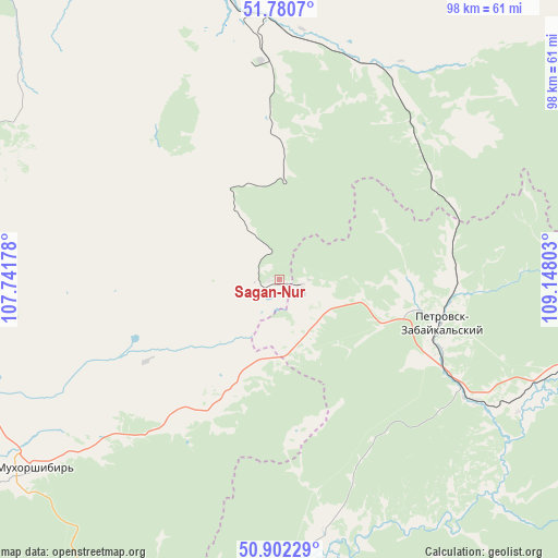
Sagan-Nur GPS coordinates[2]
51° 20' 36.96" North, 108° 26' 41.64" East
| Map corner | latitude | longitude |
|---|---|---|
| Upper-left | 51.7807°, | 107.74178° |
| Center: | 51.3436°, | 108.4449° |
| Lower-right: | 50.90229°, | 109.14803° |
| Map W x H: | 97.7×97.7 km | = 60.7×60.7mi |
| max Lat: | 73.50819° ⇑73.3% North |
| Sagan-Nur: | 51.3436° |
| min Lat: | ⇓26.7% South 41.28413° |
| min Long | Sagan-Nur | max Long |
| -179.12198° | 108.4449° | 179.35046° |
| W 90.9%⇐ | ⇒9.1% E |
Elevation
Elevation of Sagan-Nur is 876 m = 2874 ft, and this is 673.4 m = 2209 ft above average elevation for this country.
| Max E: |
2518 m = 8261 ft | 2% |
| Sagan-Nur | 876 m 2874 ft | |
| Avg. | 202.6 m = 665 ft | |
Min E: |
-28 m = -92 ft | 98% |
See also: Russia elevation on elevation.city.
Geographical zone
Sagan-Nur is located in North temperate zone (between Tropic of Cancer and the Arctic Circle). Distance of this North polar circle is 1692.3 km =1051.5 mi to North.| Distance of | km | miles | from Sagan-Nur |
|---|---|---|---|
| North Pole | 4298.2 | 2670.8 | to North |
| Arctic Circle | 1692.3 | 1051.5 | to North |
| Tropic Cancer | 3103 | 1928.1 | to South |
| Equator | 5708.9 | 3547.3 | to South |


Nearby cities:
15 places around Sagan-Nur: (largest is in red/bold)
• Balyaga
39.7 km =24.7 mi,  122°
122°
• Bol’shoy Kunaley
58.8 km =36.5 mi,  279°
279°
• Il’ka
42.3 km =26.3 mi,  7°
7°
• Khonkholoy
28.1 km =17.5 mi,  213°
213°
• Mukhorshibir’
53.9 km =33.5 mi,  232°
232°
• Nikolayevskiy
56.5 km =35.1 mi,  307°
307°
• Nikol’sk
19.2 km =11.9 mi, 206°
• Novaya Bryan’
43.2 km =26.8 mi,  343°
343°
• Novopavlovka
55.2 km =34.3 mi,  104°
104°
• Novyy Zagan
59 km =36.7 mi, 233°
• Onokhoy
70.1 km =43.6 mi, 338°
• Petrovsk-Zabaykal’skiy
28.7 km =17.8 mi,  105°
105°
• Sharalday
66 km =41 mi,  237°
237°
• Tarbagatay
48.9 km =30.4 mi, 112°
• Zaigrayevo
56 km =34.8 mi,  347°
347°
Sources, notices
• [Note1] Compared only with cities in Russia existing in our database
• [Src1] Map data: © OpenStreetMap contributors (CC-BY-SA)
• [Src2] Other city data from geonames.org with taken over terms of usage.
• [Src3] Geographical zone / Annual Mean Temperature by Robert A. Rohde @ Wikipedia
