Dalnerechensk geodata
Dalnerechensk (Primorskiy (Maritime) Kray) is a populated place; located in Russia in Asia/Vladivostok (GMT+10) time zone. With population of 28,300 people, there are 691 cities with bigger population in this country. Compared to other cities in Russia, 84.3% of cities are located further ↑North; 96.5% of cities are located further ←West and 82.8% of cities have higher elevation than Dalnerechensk. Note1


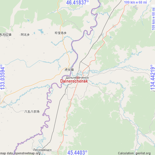
Dalnerechensk GPS coordinates[2]
45° 55' 53.364" North, 133° 44' 20.616" East
| Map corner | latitude | longitude |
|---|---|---|
| Upper-left | 46.41837°, | 133.03594° |
| Center: | 45.93149°, | 133.73906° |
| Lower-right: | 45.4403°, | 134.44219° |
| Map W x H: | 108.8×108.8 km | = 67.6×67.6mi |
| max Lat: | 73.50819° ⇑84.3% North |
| Dalnerechensk: | 45.93149° |
| min Lat: | ⇓15.7% South 41.28413° |
| min Long | Dalnerechensk | max Long |
| -179.12198° | 133.73906° | 179.35046° |
| W 96.5%⇐ | ⇒3.5% E |
Elevation
Elevation of Dalnerechensk is 59 m = 194 ft, and this is 143.6 m = 471 ft below average elevation for this country.
| Max E: |
2518 m = 8261 ft | 82.8% |
| Avg. | 202.6 m = 665 ft | |
| Dalnerechensk | 59 m = 194 ft | |
Min E: |
-28 m = -92 ft | 17.2% |
See also: Russia elevation on elevation.city.
Geographical zone
Dalnerechensk is located in North temperate zone (between Tropic of Cancer and the Arctic Circle). Distance of this North polar circle is 2294.1 km =1425.5 mi to North.| Distance of | km | miles | from Dalnerechensk |
|---|---|---|---|
| North Pole | 4900 | 3044.7 | to North |
| Arctic Circle | 2294.1 | 1425.5 | to North |
| Tropic Cancer | 2501.2 | 1554.2 | to South |
| Equator | 5107.1 | 3173.4 | to South |


Nearby cities:
15 places around Dalnerechensk: (largest is in red/bold)
• Bikin
105.6 km =65.6 mi,  21°
21°
• Chkalovskoye
133.2 km =82.8 mi,  204°
204°
• Dostoyevka
179.7 km =111.7 mi,  186°
186°
• Gornyye Klyuchi
78.8 km =49 mi, 193°
• Kamen’-Rybolov
186.8 km =116.1 mi,  225°
225°
• Kirovskiy
95.1 km =59.1 mi, 191°
• Lazo
9.7 km =6 mi, 225°
• Lermontovka
142.7 km =88.7 mi, 18°
• Lesozavodsk
55.8 km =34.7 mi,  205°
205°
• Luchegorsk
70 km =43.5 mi,  30°
30°
• Novopokrovka
59.6 km =37 mi,  98°
98°
• Spassk-Dal’niy
164.5 km =102.2 mi, 205°
• Spasskoye
164.1 km =102 mi, 206°
• Vostok
170.8 km =106.1 mi,  70°
70°
• Yakovlevka
168.7 km =104.8 mi, 187°
Sources, notices
• [Note1] Compared only with cities in Russia existing in our database
• [Src1] Map data: © OpenStreetMap contributors (CC-BY-SA)
• [Src2] Other city data from geonames.org with taken over terms of usage.
• [Src3] Geographical zone / Annual Mean Temperature by Robert A. Rohde @ Wikipedia
