Mezgor'e geodata
Mezgor'e (Bashkortostan Republic) is a populated place; located in Russia in Asia/Yekaterinburg (GMT+5) time zone. With population of 15,861 people, there are 1043 cities with bigger population in this country. Compared to other cities in Russia, 54.8% of cities are located further ↑North; 69.4% of cities are located further ←West and 94.9% of cities have lower elevation than Mezgor'e. Note1


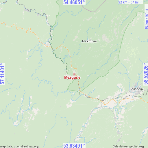
Mezgor'e GPS coordinates[2]
54° 2' 59.136" North, 57° 49' 1.668" East
| Map corner | latitude | longitude |
|---|---|---|
| Upper-left | 54.46051°, | 57.11401° |
| Center: | 54.04976°, | 57.81713° |
| Lower-right: | 53.63491°, | 58.52026° |
| Map W x H: | 91.8×91.8 km | = 57×57mi |
| max Lat: | 73.50819° ⇑54.8% North |
| Mezgor'e: | 54.04976° |
| min Lat: | ⇓45.2% South 41.28413° |
| min Long | Mezgor'e | max Long |
| -179.12198° | 57.81713° | 179.35046° |
| W 69.4%⇐ | ⇒30.6% E |
Elevation
Elevation of Mezgor'e is 627 m = 2057 ft, and this is 424.4 m = 1392 ft above average elevation for this country.
| Max E: |
2518 m = 8261 ft | 5.1% |
| Mezgor'e | 627 m 2057 ft | |
| Avg. | 202.6 m = 665 ft | |
Min E: |
-28 m = -92 ft | 94.9% |
See also: Russia elevation on elevation.city.
Geographical zone
Mezgor'e is located in North temperate zone (between Tropic of Cancer and the Arctic Circle). Distance of this North polar circle is 1391.4 km =864.6 mi to North.| Distance of | km | miles | from Mezgor'e |
|---|---|---|---|
| North Pole | 3997.3 | 2483.8 | to North |
| Arctic Circle | 1391.4 | 864.6 | to North |
| Tropic Cancer | 3403.9 | 2115.1 | to South |
| Equator | 6009.8 | 3734.3 | to South |


Nearby cities:
15 places around Mezgor'e: (largest is in red/bold)
• Abzakovo
56.4 km =35 mi,  115°
115°
• Beloretsk
39.2 km =24.4 mi,  104°
104°
• Galiakberovo
100.1 km =62.2 mi,  210°
210°
• Inzer
25.2 km =15.7 mi,  317°
317°
• Katav-Ivanovsk
81.9 km =50.9 mi,  17°
17°
• Lomovka
38.8 km =24.1 mi,  111°
111°
• Mindyak
63.5 km =39.5 mi,  92°
92°
• Mishkino
84.4 km =52.4 mi, 93°
• Tirlyanskiy
52.9 km =32.9 mi,  70°
70°
• Trëkhgornyy
94.7 km =58.8 mi,  26°
26°
• Tukan
33.2 km =20.6 mi,  225°
225°
• Ust’-Katav
101.3 km =62.9 mi,  13°
13°
• Verkhneural’sk
93.2 km =57.9 mi, 101°
• Verkhniy Avzyan
60.8 km =37.8 mi,  197°
197°
• Yuryuzan’
98.5 km =61.2 mi, 23°
Sources, notices
• [Note1] Compared only with cities in Russia existing in our database
• [Src1] Map data: © OpenStreetMap contributors (CC-BY-SA)
• [Src2] Other city data from geonames.org with taken over terms of usage.
• [Src3] Geographical zone / Annual Mean Temperature by Robert A. Rohde @ Wikipedia
