Galiakberovo geodata
Galiakberovo (Bashkortostan Republic) is a populated place; located in Russia in Asia/Yekaterinburg (GMT+5) time zone. With population of 1,000 people, there are 4627 cities with bigger population in this country. Compared to other cities in Russia, 60.6% of cities are located further ↑North; 68.6% of cities are located further ←West and 88.8% of cities have lower elevation than Galiakberovo. Note1


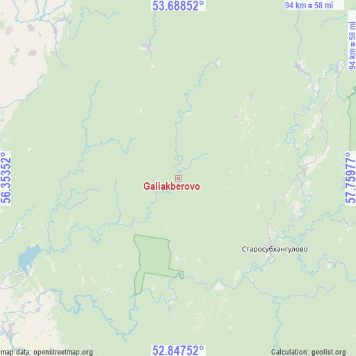
Galiakberovo GPS coordinates[2]
53° 16' 12.324" North, 57° 3' 23.904" East
| Map corner | latitude | longitude |
|---|---|---|
| Upper-left | 53.68852°, | 56.35352° |
| Center: | 53.27009°, | 57.05664° |
| Lower-right: | 52.84752°, | 57.75977° |
| Map W x H: | 93.5×93.5 km | = 58.1×58.1mi |
| max Lat: | 73.50819° ⇑60.6% North |
| Galiakberovo: | 53.27009° |
| min Lat: | ⇓39.4% South 41.28413° |
| min Long | Galiakberovo | max Long |
| -179.12198° | 57.05664° | 179.35046° |
| W 68.6%⇐ | ⇒31.4% E |
Elevation
Elevation of Galiakberovo is 424 m = 1391 ft, and this is 221.4 m = 726 ft above average elevation for this country.
| Max E: |
2518 m = 8261 ft | 11.2% |
| Galiakberovo | 424 m 1391 ft | |
| Avg. | 202.6 m = 665 ft | |
Min E: |
-28 m = -92 ft | 88.8% |
See also: Russia elevation on elevation.city.
Geographical zone
Galiakberovo is located in North temperate zone (between Tropic of Cancer and the Arctic Circle). Distance of this North polar circle is 1478.1 km =918.4 mi to North.| Distance of | km | miles | from Galiakberovo |
|---|---|---|---|
| North Pole | 4084 | 2537.7 | to North |
| Arctic Circle | 1478.1 | 918.4 | to North |
| Tropic Cancer | 3317.2 | 2061.2 | to South |
| Equator | 5923.1 | 3680.4 | to South |


Nearby cities:
15 places around Galiakberovo: (largest is in red/bold)
• Ishimbay
70.4 km =43.7 mi,  286°
286°
• Kumertau
101.9 km =63.3 mi,  236°
236°
• Meleuz
82.3 km =51.1 mi,  245°
245°
• Mezgor'e
100.1 km =62.2 mi,  30°
30°
• Mrakovo
68.1 km =42.3 mi,  205°
205°
• Salavat
77.3 km =48 mi,  279°
279°
• Starosubkhangulovo
31.7 km =19.7 mi,  125°
125°
• Sterlitamak
83.2 km =51.7 mi,  298°
298°
• Temyasovo
76.2 km =47.3 mi,  113°
113°
• Tubinskiy
88.6 km =55.1 mi,  118°
118°
• Tukan
68.7 km =42.7 mi,  22°
22°
• Verkhniy Avzyan
42.9 km =26.7 mi,  47°
47°
• Voskresenskoye
62.8 km =39 mi, 254°
• Yumaguzino
60.2 km =37.4 mi,  227°
227°
• Zirgan
75.9 km =47.2 mi,  265°
265°
Sources, notices
• [Note1] Compared only with cities in Russia existing in our database
• [Src1] Map data: © OpenStreetMap contributors (CC-BY-SA)
• [Src2] Other city data from geonames.org with taken over terms of usage.
• [Src3] Geographical zone / Annual Mean Temperature by Robert A. Rohde @ Wikipedia
