Pestretsy geodata
Pestretsy (Tatarstan Republic) is a populated place; located in Russia in Europe/Moscow (GMT+3) time zone. With population of 7,311 people, there are 1929 cities with bigger population in this country. Compared to other cities in Russia, 62.8% of cities are located further ↓South; 61.6% of cities are located further ←West and 71.9% of cities have higher elevation than Pestretsy. Note1


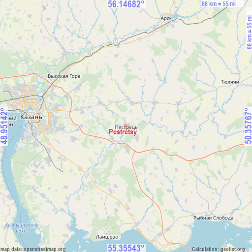
Pestretsy GPS coordinates[2]
55° 45' 11.268" North, 49° 39' 16.344" East
| Map corner | latitude | longitude |
|---|---|---|
| Upper-left | 56.14682°, | 48.95142° |
| Center: | 55.75313°, | 49.65454° |
| Lower-right: | 55.35543°, | 50.35767° |
| Map W x H: | 88×88 km | = 54.7×54.7mi |
| max Lat: | 73.50819° ⇑37.2% North |
| Pestretsy: | 55.75313° |
| min Lat: | ⇓62.8% South 41.28413° |
| min Long | Pestretsy | max Long |
| -179.12198° | 49.65454° | 179.35046° |
| W 61.6%⇐ | ⇒38.4% E |
Elevation
Elevation of Pestretsy is 98 m = 322 ft, and this is 104.6 m = 343 ft below average elevation for this country.
| Max E: |
2518 m = 8261 ft | 71.9% |
| Avg. | 202.6 m = 665 ft | |
| Pestretsy | 98 m = 322 ft | |
Min E: |
-28 m = -92 ft | 28.1% |
See also: Russia elevation on elevation.city.
Geographical zone
Pestretsy is located in North temperate zone (between Tropic of Cancer and the Arctic Circle). Distance of this North polar circle is 1202 km =746.9 mi to North.| Distance of | km | miles | from Pestretsy |
|---|---|---|---|
| North Pole | 3807.9 | 2366.1 | to North |
| Arctic Circle | 1202 | 746.9 | to North |
| Tropic Cancer | 3593.2 | 2232.7 | to South |
| Equator | 6199.2 | 3852 | to South |


Nearby cities:
15 places around Pestretsy: (largest is in red/bold)
• Alekseyevskoye
57.4 km =35.7 mi,  149°
149°
• Arsk
40.1 km =24.9 mi,  20°
20°
• Aysha
65.2 km =40.5 mi,  281°
281°
• Bogatyye Saby
57.2 km =35.5 mi,  59°
59°
• Kazan
33.5 km =20.8 mi, 276°
• Laishevo
39.3 km =24.4 mi,  189°
189°
• Osinovo
50.4 km =31.3 mi,  286°
286°
• Rybnaya Sloboda
44.6 km =27.7 mi,  136°
136°
• Staroye Arakchino
43.1 km =26.8 mi, 277°
• Stolbishchi
29.9 km =18.6 mi,  246°
246°
• Sviyazhsk
62.2 km =38.6 mi,  272°
272°
• Tyulyachi
39.7 km =24.7 mi,  67°
67°
• Vasil’yevo
63 km =39.1 mi, 278°
• Verkhniy Uslon
42.1 km =26.2 mi, 272°
• Vysokaya Gora
28.3 km =17.6 mi,  308°
308°
Sources, notices
• [Note1] Compared only with cities in Russia existing in our database
• [Src1] Map data: © OpenStreetMap contributors (CC-BY-SA)
• [Src2] Other city data from geonames.org with taken over terms of usage.
• [Src3] Geographical zone / Annual Mean Temperature by Robert A. Rohde @ Wikipedia
