Voznesenskoye geodata
Voznesenskoye (Nizhny Novgorod Oblast) is a populated place; located in Russia in Europe/Moscow (GMT+3) time zone. With population of 6,252 people, there are 2192 cities with bigger population in this country. Compared to other cities in Russia, 52% of cities are located further ↓South; 57.6% of cities are located further →East and 65.3% of cities have higher elevation than Voznesenskoye. Note1


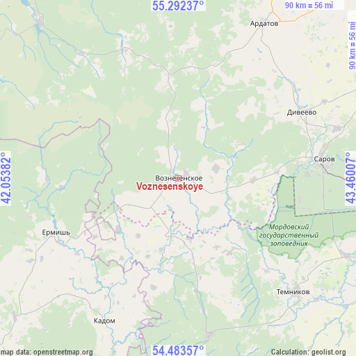
Voznesenskoye GPS coordinates[2]
54° 53' 24" North, 42° 45' 24.984" East
| Map corner | latitude | longitude |
|---|---|---|
| Upper-left | 55.29237°, | 42.05382° |
| Center: | 54.89°, | 42.75694° |
| Lower-right: | 54.48357°, | 43.46007° |
| Map W x H: | 89.9×89.9 km | = 55.9×55.9mi |
| max Lat: | 73.50819° ⇑48% North |
| Voznesenskoye: | 54.89° |
| min Lat: | ⇓52% South 41.28413° |
| min Long | Voznesenskoye | max Long |
| -179.12198° | 42.75694° | 179.35046° |
| W 42.4%⇐ | ⇒57.6% E |
Elevation
Elevation of Voznesenskoye is 113 m = 371 ft, and this is 89.6 m = 294 ft below average elevation for this country.
| Max E: |
2518 m = 8261 ft | 65.3% |
| Avg. | 202.6 m = 665 ft | |
| Voznesenskoye | 113 m = 371 ft | |
Min E: |
-28 m = -92 ft | 34.7% |
See also: Russia elevation on elevation.city.
Geographical zone
Voznesenskoye is located in North temperate zone (between Tropic of Cancer and the Arctic Circle). Distance of this North polar circle is 1298 km =806.5 mi to North.| Distance of | km | miles | from Voznesenskoye |
|---|---|---|---|
| North Pole | 3903.9 | 2425.8 | to North |
| Arctic Circle | 1298 | 806.5 | to North |
| Tropic Cancer | 3497.3 | 2173.1 | to South |
| Equator | 6103.2 | 3792.4 | to South |


Nearby cities:
15 places around Voznesenskoye: (largest is in red/bold)
• Ardatov
44.7 km =27.8 mi,  28°
28°
• Barashevo
40.5 km =25.2 mi,  168°
168°
• Diveyevo
35.3 km =21.9 mi,  61°
61°
• Gremyachevo
58.4 km =36.3 mi,  17°
17°
• Kadom
41.2 km =25.6 mi,  206°
206°
• Partsa
58.7 km =36.5 mi, 173°
• Sarov
36.6 km =22.7 mi,  81°
81°
• Satis
30.4 km =18.9 mi, 83°
• Sosnovka
39.9 km =24.8 mi,  119°
119°
• Temnikov
41.2 km =25.6 mi,  134°
134°
• Ten’gushevo
13.7 km =8.5 mi,  190°
190°
• Velet’ma
53.9 km =33.5 mi,  336°
336°
• Vilya
52.7 km =32.7 mi,  318°
318°
• Yavas
53 km =32.9 mi, 173°
• Yermish’
34 km =21.1 mi,  246°
246°
Sources, notices
• [Note1] Compared only with cities in Russia existing in our database
• [Src1] Map data: © OpenStreetMap contributors (CC-BY-SA)
• [Src2] Other city data from geonames.org with taken over terms of usage.
• [Src3] Geographical zone / Annual Mean Temperature by Robert A. Rohde @ Wikipedia
