Gremyachevo geodata
Gremyachevo (Nizhny Novgorod Oblast) is a populated place; located in Russia in Europe/Moscow (GMT+3) time zone. With population of 5,131 people, there are 2594 cities with bigger population in this country. Compared to other cities in Russia, 57.1% of cities are located further ↓South; 56.7% of cities are located further →East and 64.2% of cities have higher elevation than Gremyachevo. Note1


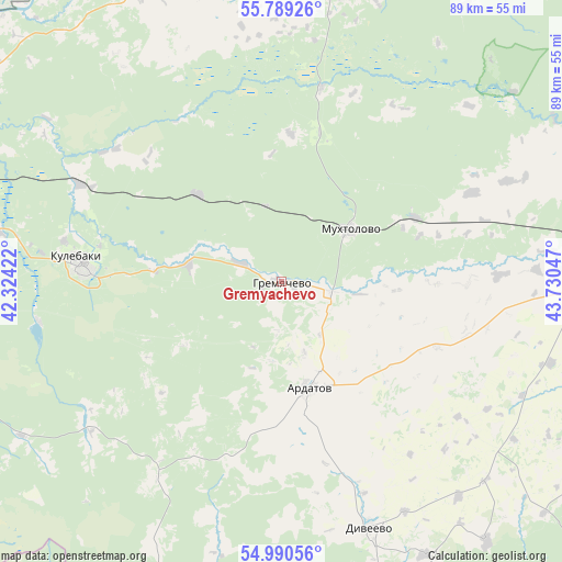
Gremyachevo GPS coordinates[2]
55° 23' 30.948" North, 43° 1' 38.424" East
| Map corner | latitude | longitude |
|---|---|---|
| Upper-left | 55.78926°, | 42.32422° |
| Center: | 55.39193°, | 43.02734° |
| Lower-right: | 54.99056°, | 43.73047° |
| Map W x H: | 88.8×88.8 km | = 55.2×55.2mi |
| max Lat: | 73.50819° ⇑42.9% North |
| Gremyachevo: | 55.39193° |
| min Lat: | ⇓57.1% South 41.28413° |
| min Long | Gremyachevo | max Long |
| -179.12198° | 43.02734° | 179.35046° |
| W 43.3%⇐ | ⇒56.7% E |
Elevation
Elevation of Gremyachevo is 115 m = 377 ft, and this is 87.6 m = 287 ft below average elevation for this country.
| Max E: |
2518 m = 8261 ft | 64.2% |
| Avg. | 202.6 m = 665 ft | |
| Gremyachevo | 115 m = 377 ft | |
Min E: |
-28 m = -92 ft | 35.8% |
See also: Russia elevation on elevation.city.
Geographical zone
Gremyachevo is located in North temperate zone (between Tropic of Cancer and the Arctic Circle). Distance of this North polar circle is 1242.2 km =771.9 mi to North.| Distance of | km | miles | from Gremyachevo |
|---|---|---|---|
| North Pole | 3848.1 | 2391.1 | to North |
| Arctic Circle | 1242.2 | 771.9 | to North |
| Tropic Cancer | 3553.1 | 2207.8 | to South |
| Equator | 6159 | 3827 | to South |


Nearby cities:
15 places around Gremyachevo: (largest is in red/bold)
• Ardatov
17.2 km =10.7 mi,  165°
165°
• Arzamas
51.3 km =31.9 mi,  89°
89°
• Chernukha
51.2 km =31.8 mi,  63°
63°
• Diveyevo
41.1 km =25.5 mi,  160°
160°
• Kulebaki
31.3 km =19.4 mi,  274°
274°
• Mukhtolovo
13.7 km =8.5 mi,  52°
52°
• Sarov
54.1 km =33.6 mi, 159°
• Satis
53.7 km =33.4 mi, 166°
• Savasleyka
45.2 km =28.1 mi,  279°
279°
• Sosnovskoye
46.8 km =29.1 mi,  10°
10°
• Vacha
48.5 km =30.1 mi,  340°
340°
• Velet’ma
38.8 km =24.1 mi,  260°
260°
• Vilya
54.3 km =33.7 mi,  252°
252°
• Vyksa
54.5 km =33.9 mi, 261°
• Vyyezdnoye
48 km =29.8 mi, 91°
Sources, notices
• [Note1] Compared only with cities in Russia existing in our database
• [Src1] Map data: © OpenStreetMap contributors (CC-BY-SA)
• [Src2] Other city data from geonames.org with taken over terms of usage.
• [Src3] Geographical zone / Annual Mean Temperature by Robert A. Rohde @ Wikipedia
