Barashevo geodata
Barashevo (Mordoviya Republic) is a populated place; located in Russia in Europe/Moscow (GMT+3) time zone. With population of 3,651 people, there are 3303 cities with bigger population in this country. Compared to other cities in Russia, 50.9% of cities are located further ↑North; 57.2% of cities are located further →East and 51.5% of cities have lower elevation than Barashevo. Note1


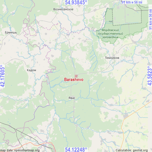
Barashevo GPS coordinates[2]
54° 31' 57" North, 42° 52' 45.012" East
| Map corner | latitude | longitude |
|---|---|---|
| Upper-left | 54.93845°, | 42.17605° |
| Center: | 54.5325°, | 42.87917° |
| Lower-right: | 54.12248°, | 43.5823° |
| Map W x H: | 90.7×90.7 km | = 56.4×56.4mi |
| max Lat: | 73.50819° ⇑50.9% North |
| Barashevo: | 54.5325° |
| min Lat: | ⇓49.1% South 41.28413° |
| min Long | Barashevo | max Long |
| -179.12198° | 42.87917° | 179.35046° |
| W 42.8%⇐ | ⇒57.2% E |
Elevation
Elevation of Barashevo is 148 m = 486 ft, and this is 54.6 m = 179 ft below average elevation for this country.
| Max E: |
2518 m = 8261 ft | 48.5% |
| Avg. | 202.6 m = 665 ft | |
| Barashevo | 148 m = 486 ft | |
Min E: |
-28 m = -92 ft | 51.5% |
See also: Russia elevation on elevation.city.
Geographical zone
Barashevo is located in North temperate zone (between Tropic of Cancer and the Arctic Circle). Distance of this North polar circle is 1337.7 km =831.2 mi to North.| Distance of | km | miles | from Barashevo |
|---|---|---|---|
| North Pole | 3943.6 | 2450.4 | to North |
| Arctic Circle | 1337.7 | 831.2 | to North |
| Tropic Cancer | 3457.5 | 2148.4 | to South |
| Equator | 6063.4 | 3767.6 | to South |


Nearby cities:
15 places around Barashevo: (largest is in red/bold)
• Kadom
26.7 km =16.6 mi,  276°
276°
• Lepley
24.9 km =15.5 mi,  182°
182°
• Partsa
18.6 km =11.6 mi, 183°
• Sarov
53.1 km =33 mi,  32°
32°
• Satis
48.9 km =30.4 mi, 27°
• Sosnovka
33.5 km =20.8 mi,  53°
53°
• Temnikov
24.2 km =15 mi,  63°
63°
• Ten’gushevo
28.2 km =17.5 mi,  338°
338°
• Torbeyevo
55.7 km =34.6 mi,  154°
154°
• Udarnyy
21.3 km =13.2 mi, 183°
• Umet
47.8 km =29.7 mi,  194°
194°
• Voznesenskoye
40.5 km =25.2 mi,  348°
348°
• Yavas
13.1 km =8.1 mi, 188°
• Yermish’
47.1 km =29.3 mi,  303°
303°
• Zubova Polyana
50.7 km =31.5 mi, 183°
Sources, notices
• [Note1] Compared only with cities in Russia existing in our database
• [Src1] Map data: © OpenStreetMap contributors (CC-BY-SA)
• [Src2] Other city data from geonames.org with taken over terms of usage.
• [Src3] Geographical zone / Annual Mean Temperature by Robert A. Rohde @ Wikipedia
