Sindor geodata
Sindor (Komi) is a populated place; located in Russia in Europe/Moscow (GMT+3) time zone. With population of 2,880 people, there are 3836 cities with bigger population in this country. Compared to other cities in Russia, 96.1% of cities are located further ↓South; 63.7% of cities are located further ←West and 63.6% of cities have lower elevation than Sindor. Note1


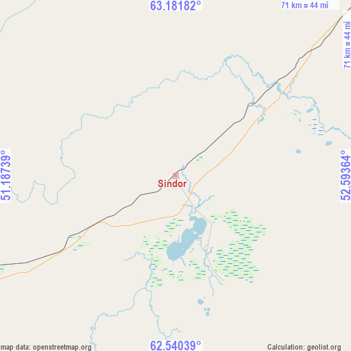
Sindor GPS coordinates[2]
62° 51' 46.296" North, 51° 53' 25.836" East
| Map corner | latitude | longitude |
|---|---|---|
| Upper-left | 63.18182°, | 51.18739° |
| Center: | 62.86286°, | 51.89051° |
| Lower-right: | 62.54039°, | 52.59364° |
| Map W x H: | 71.3×71.3 km | = 44.3×44.3mi |
| max Lat: | 73.50819° ⇑3.9% North |
| Sindor: | 62.86286° |
| min Lat: | ⇓96.1% South 41.28413° |
| min Long | Sindor | max Long |
| -179.12198° | 51.89051° | 179.35046° |
| W 63.7%⇐ | ⇒36.3% E |
Elevation
Elevation of Sindor is 178 m = 584 ft, and this is 24.6 m = 81 ft below average elevation for this country.
| Max E: |
2518 m = 8261 ft | 36.4% |
| Avg. | 202.6 m = 665 ft | |
| Sindor | 178 m = 584 ft | |
Min E: |
-28 m = -92 ft | 63.6% |
See also: Russia elevation on elevation.city.
Geographical zone
Sindor is located in North temperate zone (between Tropic of Cancer and the Arctic Circle). Distance of this North polar circle is 411.5 km =255.7 mi to North.| Distance of | km | miles | from Sindor |
|---|---|---|---|
| North Pole | 3017.4 | 1874.9 | to North |
| Arctic Circle | 411.5 | 255.7 | to North |
| Tropic Cancer | 4383.8 | 2724 | to South |
| Equator | 6989.7 | 4343.2 | to South |


Nearby cities:
15 places around Sindor: (largest is in red/bold)
• Aykino
120.4 km =74.8 mi,  233°
233°
• Borovoy
64.9 km =40.3 mi,  50°
50°
• Ezhva
131.3 km =81.6 mi,  207°
207°
• Kortkeros
118.1 km =73.4 mi,  187°
187°
• Mikun’
108.6 km =67.5 mi,  238°
238°
• Sedkyrkeshch
133.6 km =83 mi,  202°
202°
• Shudayag
113.3 km =70.4 mi, 49°
• Sosnogorsk
129.2 km =80.3 mi, 50°
• Syktyvkar
144.4 km =89.7 mi, 202°
• Ukhta
119.2 km =74.1 mi, 48°
• Ust’-Vym’
104.5 km =64.9 mi, 227°
• Vodnyy
104.4 km =64.9 mi, 46°
• Yarega
105.9 km =65.8 mi, 53°
• Yemva
60.7 km =37.7 mi, 239°
• Zelenets
123.6 km =76.8 mi, 208°
Sources, notices
• [Note1] Compared only with cities in Russia existing in our database
• [Src1] Map data: © OpenStreetMap contributors (CC-BY-SA)
• [Src2] Other city data from geonames.org with taken over terms of usage.
• [Src3] Geographical zone / Annual Mean Temperature by Robert A. Rohde @ Wikipedia
