Velikooktyabr’skiy geodata
Velikooktyabr’skiy (Tver’ Oblast) is a populated place; located in Russia in Europe/Moscow (GMT+3) time zone. With population of 2,472 people, there are 3970 cities with bigger population in this country. Compared to other cities in Russia, 79.7% of cities are located further ↓South; 90.8% of cities are located further →East and 73% of cities have lower elevation than Velikooktyabr’skiy. Note1


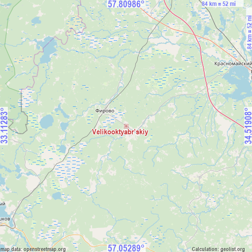
Velikooktyabr’skiy GPS coordinates[2]
57° 25' 59.988" North, 33° 48' 57.42" East
| Map corner | latitude | longitude |
|---|---|---|
| Upper-left | 57.80986°, | 33.11283° |
| Center: | 57.43333°, | 33.81595° |
| Lower-right: | 57.05289°, | 34.51908° |
| Map W x H: | 84.2×84.2 km | = 52.3×52.3mi |
| max Lat: | 73.50819° ⇑20.3% North |
| Velikooktyabr’skiy: | 57.43333° |
| min Lat: | ⇓79.7% South 41.28413° |
| min Long | Velikooktyabr� | max Long |
| -179.12198° | 33.81595° | 179.35046° |
| W 9.2%⇐ | ⇒90.8% E |
Elevation
Elevation of Velikooktyabr’skiy is 208 m = 682 ft, and this is 5.4 m = 18 ft above average elevation for this country.
| Max E: |
2518 m = 8261 ft | 27% |
| Velikooktyabr’skiy | 208 m 682 ft | |
| Avg. | 202.6 m = 665 ft | |
Min E: |
-28 m = -92 ft | 73% |
See also: Russia elevation on elevation.city.
Geographical zone
Velikooktyabr’skiy is located in North temperate zone (between Tropic of Cancer and the Arctic Circle). Distance of this North polar circle is 1015.2 km =630.8 mi to North.| Distance of | km | miles | from Velikooktyabr’skiy |
|---|---|---|---|
| North Pole | 3621.1 | 2250 | to North |
| Arctic Circle | 1015.2 | 630.8 | to North |
| Tropic Cancer | 3780.1 | 2348.8 | to South |
| Equator | 6386 | 3968.1 | to South |


Nearby cities:
15 places around Velikooktyabr’skiy: (largest is in red/bold)
• Berezayka
61.9 km =38.5 mi,  4°
4°
• Berëzovskiy Ryadok
62.6 km =38.9 mi,  256°
256°
• Bologoye
52.2 km =32.4 mi,  15°
15°
• Bologoye-4
52.8 km =32.8 mi,  349°
349°
• Firovo
8.7 km =5.4 mi,  308°
308°
• Krasnomayskiy
41.1 km =25.5 mi,  59°
59°
• Kuvshinovo
49.8 km =30.9 mi,  154°
154°
• Kuzhenkino
37.3 km =23.2 mi,  12°
12°
• Ostashkov
53.2 km =33.1 mi,  233°
233°
• Trud
21.5 km =13.4 mi, 24°
• Vydropuzhsk
62 km =38.5 mi,  97°
97°
• Vypolzovo
49.8 km =30.9 mi, 351°
• Vyshniy Volochëk
48 km =29.8 mi,  68°
68°
• Yedrovo
54.6 km =33.9 mi, 347°
• Zimogor’ye
66.6 km =41.4 mi,  331°
331°
Sources, notices
• [Note1] Compared only with cities in Russia existing in our database
• [Src1] Map data: © OpenStreetMap contributors (CC-BY-SA)
• [Src2] Other city data from geonames.org with taken over terms of usage.
• [Src3] Geographical zone / Annual Mean Temperature by Robert A. Rohde @ Wikipedia
