Bologoye geodata
Bologoye (Tver’ Oblast) is a seat of a second-order administrative division; located in Russia in Europe/Moscow (GMT+3) time zone. With population of 25,142 people, there are 748 cities with bigger population in this country. Compared to other cities in Russia, 82% of cities are located further ↓South; 90.5% of cities are located further →East and 56.8% of cities have lower elevation than Bologoye. Note1


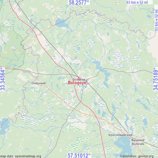
Bologoye GPS coordinates[2]
57° 53' 9.06" North, 34° 2' 55.536" East
| Map corner | latitude | longitude |
|---|---|---|
| Upper-left | 58.2577°, | 33.34564° |
| Center: | 57.88585°, | 34.04876° |
| Lower-right: | 57.51012°, | 34.75189° |
| Map W x H: | 83.1×83.1 km | = 51.6×51.6mi |
| max Lat: | 73.50819° ⇑18% North |
| Bologoye: | 57.88585° |
| min Lat: | ⇓82% South 41.28413° |
| min Long | Bologoye | max Long |
| -179.12198° | 34.04876° | 179.35046° |
| W 9.5%⇐ | ⇒90.5% E |
Elevation
Elevation of Bologoye is 160 m = 525 ft, and this is 42.6 m = 140 ft below average elevation for this country.
| Max E: |
2518 m = 8261 ft | 43.2% |
| Avg. | 202.6 m = 665 ft | |
| Bologoye | 160 m = 525 ft | |
Min E: |
-28 m = -92 ft | 56.8% |
See also: Russia elevation on elevation.city.
Geographical zone
Bologoye is located in North temperate zone (between Tropic of Cancer and the Arctic Circle). Distance of this North polar circle is 964.9 km =599.6 mi to North.| Distance of | km | miles | from Bologoye |
|---|---|---|---|
| North Pole | 3570.8 | 2218.8 | to North |
| Arctic Circle | 964.9 | 599.6 | to North |
| Tropic Cancer | 3830.4 | 2380.1 | to South |
| Equator | 6436.3 | 3999.3 | to South |


Nearby cities:
15 places around Bologoye: (largest is in red/bold)
• Berezayka
14.3 km =8.9 mi,  323°
323°
• Bologoye-4
23.6 km =14.7 mi,  273°
273°
• Firovo
49.5 km =30.8 mi,  204°
204°
• Krasnomayskiy
36.6 km =22.7 mi,  144°
144°
• Kuzhenkino
15 km =9.3 mi, 202°
• Lykoshino
31.4 km =19.5 mi, 320°
• Opechenskiy Posad
43.5 km =27 mi,  5°
5°
• Trud
31.1 km =19.3 mi,  189°
189°
• Uglovka
50.4 km =31.3 mi, 321°
• Valday
48.4 km =30.1 mi,  282°
282°
• Velikooktyabr’skiy
52.2 km =32.4 mi, 195°
• Vypolzovo
20.7 km =12.9 mi, 267°
• Vyshniy Volochëk
44.8 km =27.8 mi, 136°
• Yedrovo
25.5 km =15.8 mi, 276°
• Zimogor’ye
46.2 km =28.7 mi, 280°
Sources, notices
• [Note1] Compared only with cities in Russia existing in our database
• [Src1] Map data: © OpenStreetMap contributors (CC-BY-SA)
• [Src2] Other city data from geonames.org with taken over terms of usage.
• [Src3] Geographical zone / Annual Mean Temperature by Robert A. Rohde @ Wikipedia
