Urmary geodata
Urmary (Chuvashia) is a populated place; located in Russia in Europe/Moscow (GMT+3) time zone. With population of 6,256 people, there are 2191 cities with bigger population in this country. Compared to other cities in Russia, 61.2% of cities are located further ↓South; 58.7% of cities are located further ←West and 56.3% of cities have lower elevation than Urmary. Note1


Urmary GPS coordinates[2]
55° 40' 44.184" North, 47° 56' 38.256" East
| Map corner | latitude | longitude |
|---|---|---|
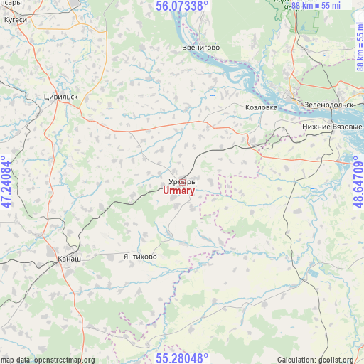
| Upper-left | 56.07338°, | 47.24084° |
| Center: | 55.67894°, | 47.94396° |
| Lower-right: | 55.28048°, | 48.64709° |
| Map W x H: | 88.2×88.2 km | = 54.8×54.8mi |
| max Lat: | 73.50819° ⇑38.8% North |
| Urmary: | 55.67894° |
| min Lat: | ⇓61.2% South 41.28413° |
| min Long | Urmary | max Long |
| -179.12198° | 47.94396° | 179.35046° |
| W 58.7%⇐ | ⇒41.3% E |
Elevation
Elevation of Urmary is 159 m = 522 ft, and this is 43.6 m = 143 ft below average elevation for this country.
| Max E: |
2518 m = 8261 ft | 43.7% |
| Avg. | 202.6 m = 665 ft | |
| Urmary | 159 m = 522 ft | |
Min E: |
-28 m = -92 ft | 56.3% |
See also: Russia elevation on elevation.city.
Geographical zone
Urmary is located in North temperate zone (between Tropic of Cancer and the Arctic Circle). Distance of this North polar circle is 1210.3 km =752 mi to North.| Distance of | km | miles | from Urmary |
|---|---|---|---|
| North Pole | 3816.1 | 2371.2 | to North |
| Arctic Circle | 1210.3 | 752 | to North |
| Tropic Cancer | 3585 | 2227.6 | to South |
| Equator | 6190.9 | 3846.8 | to South |


Nearby cities:
15 places around Urmary: (largest is in red/bold)
• Atlashevo
44.3 km =27.5 mi,  326°
326°
• Aysha
48 km =29.8 mi,  63°
63°
• Kanash
34.1 km =21.2 mi,  236°
236°
• Kozlovka
26.4 km =16.4 mi,  46°
46°
• Nizhniye Vyazovyye
38.7 km =24 mi,  69°
69°
• Pomary
41 km =25.5 mi,  38°
38°
• Privolzhskiy
43 km =26.7 mi, 43°
• Shikhazany
37 km =23 mi,  249°
249°
• Sviyazhsk
46.1 km =28.6 mi,  76°
76°
• Tsivil’sk
36 km =22.4 mi,  306°
306°
• Vasil’yevo
48 km =29.8 mi, 68°
• Volzhsk
33.3 km =20.7 mi, 51°
• Yantikovo
16 km =9.9 mi,  352°
352°
• Zelenodolsk
40.3 km =25 mi, 62°
• Zvenigovo
33.2 km =20.6 mi,  7°
7°
Sources, notices
• [Note1] Compared only with cities in Russia existing in our database
• [Src1] Map data: © OpenStreetMap contributors (CC-BY-SA)
• [Src2] Other city data from geonames.org with taken over terms of usage.
• [Src3] Geographical zone / Annual Mean Temperature by Robert A. Rohde @ Wikipedia
