Yantikovo geodata
Yantikovo (Chuvashia) is a populated place; located in Russia in Europe/Moscow (GMT+3) time zone. With population of 3,331 people, there are 3507 cities with bigger population in this country. Compared to other cities in Russia, 64% of cities are located further ↓South; 58.6% of cities are located further ←West and 72.2% of cities have higher elevation than Yantikovo. Note1


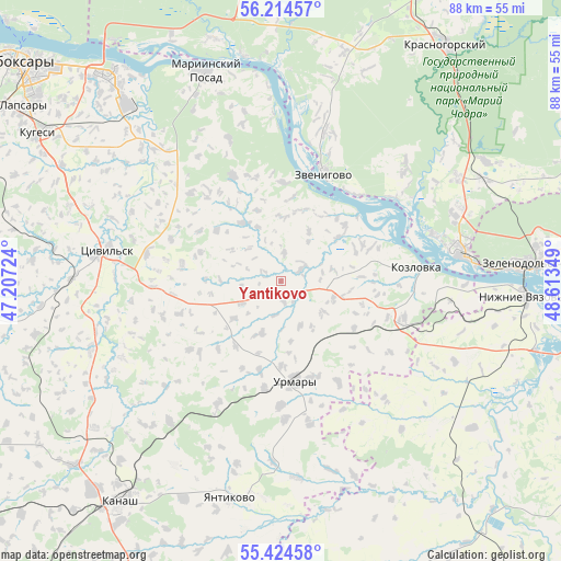
Yantikovo GPS coordinates[2]
55° 49' 17.688" North, 47° 54' 37.296" East
| Map corner | latitude | longitude |
|---|---|---|
| Upper-left | 56.21457°, | 47.20724° |
| Center: | 55.82158°, | 47.91036° |
| Lower-right: | 55.42458°, | 48.61349° |
| Map W x H: | 87.8×87.8 km | = 54.6×54.6mi |
| max Lat: | 73.50819° ⇑36% North |
| Yantikovo: | 55.82158° |
| min Lat: | ⇓64% South 41.28413° |
| min Long | Yantikovo | max Long |
| -179.12198° | 47.91036° | 179.35046° |
| W 58.6%⇐ | ⇒41.4% E |
Elevation
Elevation of Yantikovo is 97 m = 318 ft, and this is 105.6 m = 346 ft below average elevation for this country.
| Max E: |
2518 m = 8261 ft | 72.2% |
| Avg. | 202.6 m = 665 ft | |
| Yantikovo | 97 m = 318 ft | |
Min E: |
-28 m = -92 ft | 27.8% |
See also: Russia elevation on elevation.city.
Geographical zone
Yantikovo is located in North temperate zone (between Tropic of Cancer and the Arctic Circle). Distance of this North polar circle is 1194.4 km =742.2 mi to North.| Distance of | km | miles | from Yantikovo |
|---|---|---|---|
| North Pole | 3800.3 | 2361.4 | to North |
| Arctic Circle | 1194.4 | 742.2 | to North |
| Tropic Cancer | 3600.9 | 2237.5 | to South |
| Equator | 6206.8 | 3856.7 | to South |


Nearby cities:
15 places around Yantikovo: (largest is in red/bold)
• Atlashevo
30.6 km =19 mi,  313°
313°
• Kanash
43.5 km =27 mi,  217°
217°
• Kozlovka
21.3 km =13.2 mi,  83°
83°
• Kugesi
44.9 km =27.9 mi,  300°
300°
• Mariinskiy Posad
34.7 km =21.6 mi,  339°
339°
• Nizhniye Vyazovyye
38.5 km =23.9 mi,  93°
93°
• Novocheboksarsk
42 km =26.1 mi,  320°
320°
• Pomary
31.9 km =19.8 mi,  59°
59°
• Privolzhskiy
35.1 km =21.8 mi, 63°
• Shikhazany
43.5 km =27 mi,  228°
228°
• Tsivil’sk
27.5 km =17.1 mi,  281°
281°
• Urmary
16 km =9.9 mi,  172°
172°
• Volzhsk
28.5 km =17.7 mi, 79°
• Zelenodolsk
38 km =23.6 mi, 86°
• Zvenigovo
18.3 km =11.4 mi,  20°
20°
Sources, notices
• [Note1] Compared only with cities in Russia existing in our database
• [Src1] Map data: © OpenStreetMap contributors (CC-BY-SA)
• [Src2] Other city data from geonames.org with taken over terms of usage.
• [Src3] Geographical zone / Annual Mean Temperature by Robert A. Rohde @ Wikipedia
