Urman geodata
Urman (Bashkortostan Republic) is a populated place; located in Russia in Asia/Yekaterinburg (GMT+5) time zone. With population of 2,509 people, there are 3951 cities with bigger population in this country. Compared to other cities in Russia, 51.9% of cities are located further ↓South; 68.4% of cities are located further ←West and 50.4% of cities have lower elevation than Urman. Note1


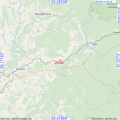
Urman GPS coordinates[2]
54° 52' 59.304" North, 56° 52' 27.012" East
| Map corner | latitude | longitude |
|---|---|---|
| Upper-left | 55.28558°, | 56.17105° |
| Center: | 54.88314°, | 56.87417° |
| Lower-right: | 54.47664°, | 57.5773° |
| Map W x H: | 89.9×89.9 km | = 55.9×55.9mi |
| max Lat: | 73.50819° ⇑48.1% North |
| Urman: | 54.88314° |
| min Lat: | ⇓51.9% South 41.28413° |
| min Long | Urman | max Long |
| -179.12198° | 56.87417° | 179.35046° |
| W 68.4%⇐ | ⇒31.6% E |
Elevation
Elevation of Urman is 145 m = 476 ft, and this is 57.6 m = 189 ft below average elevation for this country.
| Max E: |
2518 m = 8261 ft | 49.6% |
| Avg. | 202.6 m = 665 ft | |
| Urman | 145 m = 476 ft | |
Min E: |
-28 m = -92 ft | 50.4% |
See also: Russia elevation on elevation.city.
Geographical zone
Urman is located in North temperate zone (between Tropic of Cancer and the Arctic Circle). Distance of this North polar circle is 1298.7 km =807 mi to North.| Distance of | km | miles | from Urman |
|---|---|---|---|
| North Pole | 3904.6 | 2426.2 | to North |
| Arctic Circle | 1298.7 | 807 | to North |
| Tropic Cancer | 3496.5 | 2172.6 | to South |
| Equator | 6102.4 | 3791.9 | to South |


Nearby cities:
15 places around Urman: (largest is in red/bold)
• Asha
28.4 km =17.6 mi,  63°
63°
• Bedeyeva Polyana
57.9 km =36 mi,  327°
327°
• Blagoveshchensk
59.6 km =37 mi,  286°
286°
• Iglino
30.1 km =18.7 mi,  259°
259°
• Kabakovo
60.3 km =37.5 mi,  230°
230°
• Krasnaya Gorka
37.2 km =23.1 mi,  339°
339°
• Krasnyy Klyuch
57.7 km =35.9 mi,  345°
345°
• Kudeyevskiy
7.6 km =4.7 mi, 263°
• Mikhaylovka
63.5 km =39.5 mi, 262°
• Pavlovka
63.2 km =39.3 mi, 341°
• Sim
54 km =33.6 mi,  76°
76°
• Ufa
60.1 km =37.3 mi,  254°
254°
• Ulu-Telyak
7.8 km =4.8 mi, 62°
• Ulukulevo
61.1 km =38 mi,  215°
215°
• Yazykovo
60.1 km =37.3 mi,  308°
308°
Sources, notices
• [Note1] Compared only with cities in Russia existing in our database
• [Src1] Map data: © OpenStreetMap contributors (CC-BY-SA)
• [Src2] Other city data from geonames.org with taken over terms of usage.
• [Src3] Geographical zone / Annual Mean Temperature by Robert A. Rohde @ Wikipedia
