Pavlovka geodata
Pavlovka (Bashkortostan Republic) is a populated place; located in Russia in Asia/Yekaterinburg (GMT+5) time zone. With population of 4,277 people, there are 2963 cities with bigger population in this country. Compared to other cities in Russia, 57.3% of cities are located further ↓South; 68.1% of cities are located further ←West and 82.4% of cities have lower elevation than Pavlovka. Note1


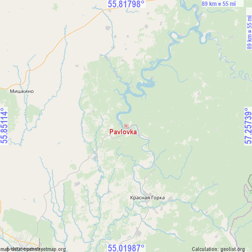
Pavlovka GPS coordinates[2]
55° 25' 15.384" North, 56° 33' 15.336" East
| Map corner | latitude | longitude |
|---|---|---|
| Upper-left | 55.81798°, | 55.85114° |
| Center: | 55.42094°, | 56.55426° |
| Lower-right: | 55.01987°, | 57.25739° |
| Map W x H: | 88.7×88.7 km | = 55.1×55.1mi |
| max Lat: | 73.50819° ⇑42.7% North |
| Pavlovka: | 55.42094° |
| min Lat: | ⇓57.3% South 41.28413° |
| min Long | Pavlovka | max Long |
| -179.12198° | 56.55426° | 179.35046° |
| W 68.1%⇐ | ⇒31.9% E |
Elevation
Elevation of Pavlovka is 278 m = 912 ft, and this is 75.4 m = 247 ft above average elevation for this country.
| Max E: |
2518 m = 8261 ft | 17.6% |
| Pavlovka | 278 m 912 ft | |
| Avg. | 202.6 m = 665 ft | |
Min E: |
-28 m = -92 ft | 82.4% |
See also: Russia elevation on elevation.city.
Geographical zone
Pavlovka is located in North temperate zone (between Tropic of Cancer and the Arctic Circle). Distance of this North polar circle is 1238.9 km =769.8 mi to North.| Distance of | km | miles | from Pavlovka |
|---|---|---|---|
| North Pole | 3844.8 | 2389 | to North |
| Arctic Circle | 1238.9 | 769.8 | to North |
| Tropic Cancer | 3556.3 | 2209.8 | to South |
| Equator | 6162.2 | 3829 | to South |


Nearby cities:
15 places around Pavlovka: (largest is in red/bold)
• Asha
65.5 km =40.7 mi,  135°
135°
• Askino
74.4 km =46.2 mi,  1°
1°
• Bedeyeva Polyana
15.1 km =9.4 mi,  223°
223°
• Birsk
63.8 km =39.6 mi,  270°
270°
• Blagoveshchensk
56.4 km =35 mi, 220°
• Iglino
66.1 km =41.1 mi,  187°
187°
• Karaidel’
51 km =31.7 mi,  25°
25°
• Karayar
42.8 km =26.6 mi,  43°
43°
• Krasnaya Gorka
26 km =16.2 mi,  164°
164°
• Krasnyy Klyuch
7.3 km =4.5 mi,  121°
121°
• Kudeyevskiy
62 km =38.5 mi,  168°
168°
• Maginsk
46 km =28.6 mi, 34°
• Ulu-Telyak
62.4 km =38.8 mi,  154°
154°
• Urman
63.2 km =39.3 mi, 161°
• Yazykovo
34.7 km =21.6 mi,  229°
229°
Sources, notices
• [Note1] Compared only with cities in Russia existing in our database
• [Src1] Map data: © OpenStreetMap contributors (CC-BY-SA)
• [Src2] Other city data from geonames.org with taken over terms of usage.
• [Src3] Geographical zone / Annual Mean Temperature by Robert A. Rohde @ Wikipedia
