Troitskoye geodata
Troitskoye (Kalmykiya Republic) is a populated place; located in Russia in Europe/Moscow (GMT+3) time zone. With population of 10,025 people, there are 1504 cities with bigger population in this country. Compared to other cities in Russia, 83.2% of cities are located further ↑North; 52.1% of cities are located further →East and 78.4% of cities have higher elevation than Troitskoye. Note1


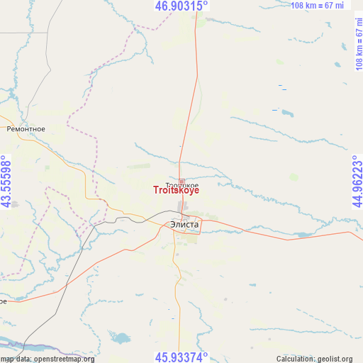
Troitskoye GPS coordinates[2]
46° 25' 14.16" North, 44° 15' 32.76" East
| Map corner | latitude | longitude |
|---|---|---|
| Upper-left | 46.90315°, | 43.55598° |
| Center: | 46.4206°, | 44.2591° |
| Lower-right: | 45.93374°, | 44.96223° |
| Map W x H: | 107.8×107.8 km | = 67×67mi |
| max Lat: | 73.50819° ⇑83.2% North |
| Troitskoye: | 46.4206° |
| min Lat: | ⇓16.8% South 41.28413° |
| min Long | Troitskoye | max Long |
| -179.12198° | 44.2591° | 179.35046° |
| W 47.9%⇐ | ⇒52.1% E |
Elevation
Elevation of Troitskoye is 76 m = 249 ft, and this is 126.6 m = 415 ft below average elevation for this country.
| Max E: |
2518 m = 8261 ft | 78.4% |
| Avg. | 202.6 m = 665 ft | |
| Troitskoye | 76 m = 249 ft | |
Min E: |
-28 m = -92 ft | 21.6% |
See also: Russia elevation on elevation.city.
Geographical zone
Troitskoye is located in North temperate zone (between Tropic of Cancer and the Arctic Circle). Distance of this North polar circle is 2239.7 km =1391.7 mi to North.| Distance of | km | miles | from Troitskoye |
|---|---|---|---|
| North Pole | 4845.6 | 3010.9 | to North |
| Arctic Circle | 2239.7 | 1391.7 | to North |
| Tropic Cancer | 2555.6 | 1588 | to South |
| Equator | 5161.5 | 3207.2 | to South |


Nearby cities:
15 places around Troitskoye: (largest is in red/bold)
• Arshan’
16.7 km =10.4 mi,  190°
190°
• Arzgir
116.5 km =72.4 mi,  181°
181°
• Divnoye
89.9 km =55.9 mi,  230°
230°
• Elista
12.5 km =7.8 mi, 181°
• Iki-Burul
73.1 km =45.4 mi,  155°
155°
• Ipatovo
130.5 km =81.1 mi, 233°
• Letnyaya Stavka
126.7 km =78.7 mi,  209°
209°
• Ovoshchi
137.8 km =85.6 mi, 211°
• Priyutnoye
67.8 km =42.1 mi,  238°
238°
• Remontnoye
49.2 km =30.6 mi,  288°
288°
• Sovetskoye
100.7 km =62.6 mi,  11°
11°
• Utta
134.2 km =83.4 mi,  92°
92°
• Volochayevskiy
123.8 km =76.9 mi,  276°
276°
• Yashkul’
87.8 km =54.6 mi,  108°
108°
• Zavetnoye
82.6 km =51.3 mi,  340°
340°
Sources, notices
• [Note1] Compared only with cities in Russia existing in our database
• [Src1] Map data: © OpenStreetMap contributors (CC-BY-SA)
• [Src2] Other city data from geonames.org with taken over terms of usage.
• [Src3] Geographical zone / Annual Mean Temperature by Robert A. Rohde @ Wikipedia
