Arzgir geodata
Arzgir (Stavropol’ Kray) is a populated place; located in Russia in Europe/Moscow (GMT+3) time zone. With population of 15,838 people, there are 1044 cities with bigger population in this country. Compared to other cities in Russia, 85.7% of cities are located further ↑North; 52.2% of cities are located further →East and 81.1% of cities have higher elevation than Arzgir. Note1


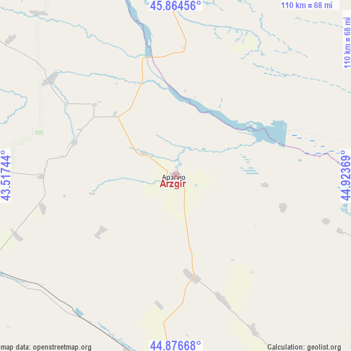
Arzgir GPS coordinates[2]
45° 22' 22.008" North, 44° 13' 14.016" East
| Map corner | latitude | longitude |
|---|---|---|
| Upper-left | 45.86456°, | 43.51744° |
| Center: | 45.37278°, | 44.22056° |
| Lower-right: | 44.87668°, | 44.92369° |
| Map W x H: | 109.8×109.8 km | = 68.2×68.2mi |
| max Lat: | 73.50819° ⇑85.7% North |
| Arzgir: | 45.37278° |
| min Lat: | ⇓14.3% South 41.28413° |
| min Long | Arzgir | max Long |
| -179.12198° | 44.22056° | 179.35046° |
| W 47.8%⇐ | ⇒52.2% E |
Elevation
Elevation of Arzgir is 67 m = 220 ft, and this is 135.6 m = 445 ft below average elevation for this country.
| Max E: |
2518 m = 8261 ft | 81.1% |
| Avg. | 202.6 m = 665 ft | |
| Arzgir | 67 m = 220 ft | |
Min E: |
-28 m = -92 ft | 18.9% |
See also: Russia elevation on elevation.city.
Geographical zone
Arzgir is located in North temperate zone (between Tropic of Cancer and the Arctic Circle). Distance of this North polar circle is 2356.2 km =1464.1 mi to North.| Distance of | km | miles | from Arzgir |
|---|---|---|---|
| North Pole | 4962.1 | 3083.3 | to North |
| Arctic Circle | 2356.2 | 1464.1 | to North |
| Tropic Cancer | 2439.1 | 1515.6 | to South |
| Equator | 5045 | 3134.8 | to South |


Nearby cities:
15 places around Arzgir: (largest is in red/bold)
• Aleksandriya
82.4 km =51.2 mi,  247°
247°
• Blagodarnyy
68.6 km =42.6 mi,  243°
243°
• Budënnovsk
65.6 km =40.8 mi,  183°
183°
• Burlatskoye
57.8 km =35.9 mi,  232°
232°
• Chernolesskoye
83.2 km =51.7 mi,  208°
208°
• Iki-Burul
59.9 km =37.2 mi,  33°
33°
• Letnyaya Stavka
60.7 km =37.7 mi,  276°
276°
• Levokumskoye
70.3 km =43.7 mi,  150°
150°
• Orlovka
75.9 km =47.2 mi, 182°
• Ovoshchi
70.1 km =43.6 mi,  269°
269°
• Pokoynoye
62.7 km =39 mi, 177°
• Praskoveya
69.9 km =43.4 mi, 181°
• Pravokumskoye
75 km =46.6 mi, 153°
• Sotnikovskoye
53.8 km =33.4 mi,  220°
220°
• Yelizavetinskoye
79.4 km =49.3 mi, 239°
Sources, notices
• [Note1] Compared only with cities in Russia existing in our database
• [Src1] Map data: © OpenStreetMap contributors (CC-BY-SA)
• [Src2] Other city data from geonames.org with taken over terms of usage.
• [Src3] Geographical zone / Annual Mean Temperature by Robert A. Rohde @ Wikipedia
