Zavetnoye geodata
Zavetnoye (Rostov) is a seat of a second-order administrative division; located in Russia in Europe/Moscow (GMT+3) time zone. With population of 6,711 people, there are 2069 cities with bigger population in this country. Compared to other cities in Russia, 82.1% of cities are located further ↑North; 53.2% of cities are located further →East and 80% of cities have higher elevation than Zavetnoye. Note1


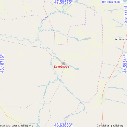
Zavetnoye GPS coordinates[2]
47° 7' 9.984" North, 43° 53' 25.008" East
| Map corner | latitude | longitude |
|---|---|---|
| Upper-left | 47.59575°, | 43.18716° |
| Center: | 47.11944°, | 43.89028° |
| Lower-right: | 46.63883°, | 44.59341° |
| Map W x H: | 106.4×106.4 km | = 66.1×66.1mi |
| max Lat: | 73.50819° ⇑82.1% North |
| Zavetnoye: | 47.11944° |
| min Lat: | ⇓17.9% South 41.28413° |
| min Long | Zavetnoye | max Long |
| -179.12198° | 43.89028° | 179.35046° |
| W 46.8%⇐ | ⇒53.2% E |
Elevation
Elevation of Zavetnoye is 71 m = 233 ft, and this is 131.6 m = 432 ft below average elevation for this country.
| Max E: |
2518 m = 8261 ft | 80% |
| Avg. | 202.6 m = 665 ft | |
| Zavetnoye | 71 m = 233 ft | |
Min E: |
-28 m = -92 ft | 20% |
See also: Russia elevation on elevation.city.
Geographical zone
Zavetnoye is located in North temperate zone (between Tropic of Cancer and the Arctic Circle). Distance of this North polar circle is 2162 km =1343.4 mi to North.| Distance of | km | miles | from Zavetnoye |
|---|---|---|---|
| North Pole | 4767.9 | 2962.6 | to North |
| Arctic Circle | 2162 | 1343.4 | to North |
| Tropic Cancer | 2633.3 | 1636.3 | to South |
| Equator | 5239.2 | 3255.5 | to South |


Nearby cities:
15 places around Zavetnoye: (largest is in red/bold)
• Arshan’
97.4 km =60.5 mi,  165°
165°
• Dubovskoye
90.7 km =56.4 mi,  291°
291°
• Elista
94.5 km =58.7 mi,  162°
162°
• Kotel’nikovo
80.1 km =49.8 mi,  315°
315°
• Krasnoarmeyskiy
128 km =79.5 mi,  264°
264°
• Krasnoyarskaya
135.1 km =83.9 mi, 288°
• Malyye Derbety
110.2 km =68.5 mi,  32°
32°
• Priyutnoye
116.9 km =72.6 mi,  194°
194°
• Remontnoye
64.7 km =40.2 mi,  196°
196°
• Sadovoye
87.2 km =54.2 mi, 32°
• Sovetskoye
52.1 km =32.4 mi,  66°
66°
• Troitskoye
82.6 km =51.3 mi, 160°
• Volgodonsk
138.2 km =85.9 mi, 288°
• Volochayevskiy
113.9 km =70.8 mi,  235°
235°
• Zimovniki
107.3 km =66.7 mi,  271°
271°
Sources, notices
• [Note1] Compared only with cities in Russia existing in our database
• [Src1] Map data: © OpenStreetMap contributors (CC-BY-SA)
• [Src2] Other city data from geonames.org with taken over terms of usage.
• [Src3] Geographical zone / Annual Mean Temperature by Robert A. Rohde @ Wikipedia
