Toksovo geodata
Toksovo (Leningradskaya Oblast') is a populated place; located in Russia in Europe/Moscow (GMT+3) time zone. With population of 5,863 people, there are 2311 cities with bigger population in this country. Compared to other cities in Russia, 91.1% of cities are located further ↓South; 95.2% of cities are located further →East and 79% of cities have higher elevation than Toksovo. Note1


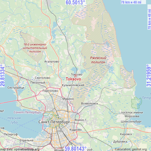
Toksovo GPS coordinates[2]
60° 9' 11.628" North, 30° 30' 59.256" East
| Map corner | latitude | longitude |
|---|---|---|
| Upper-left | 60.5013°, | 29.81334° |
| Center: | 60.15323°, | 30.51646° |
| Lower-right: | 59.80143°, | 31.21959° |
| Map W x H: | 77.8×77.8 km | = 48.3×48.3mi |
| max Lat: | 73.50819° ⇑8.9% North |
| Toksovo: | 60.15323° |
| min Lat: | ⇓91.1% South 41.28413° |
| min Long | Toksovo | max Long |
| -179.12198° | 30.51646° | 179.35046° |
| W 4.8%⇐ | ⇒95.2% E |
Elevation
Elevation of Toksovo is 74 m = 243 ft, and this is 128.6 m = 422 ft below average elevation for this country.
| Max E: |
2518 m = 8261 ft | 79% |
| Avg. | 202.6 m = 665 ft | |
| Toksovo | 74 m = 243 ft | |
Min E: |
-28 m = -92 ft | 21% |
See also: Russia elevation on elevation.city.
Geographical zone
Toksovo is located in North temperate zone (between Tropic of Cancer and the Arctic Circle). Distance of this North polar circle is 712.8 km =442.9 mi to North.| Distance of | km | miles | from Toksovo |
|---|---|---|---|
| North Pole | 3318.6 | 2062.1 | to North |
| Arctic Circle | 712.8 | 442.9 | to North |
| Tropic Cancer | 4082.5 | 2536.7 | to South |
| Equator | 6688.4 | 4156 | to South |


Nearby cities:
15 places around Toksovo: (largest is in red/bold)
• Agalatovo
15.3 km =9.5 mi,  298°
298°
• Akademicheskoe
16.9 km =10.5 mi,  203°
203°
• Bugry
11.4 km =7.1 mi,  217°
217°
• Grazhdanka
14.4 km =8.9 mi,  205°
205°
• Leskolovo
12.7 km =7.9 mi,  344°
344°
• Luppolovo
13.1 km =8.1 mi,  270°
270°
• Murino
12.2 km =7.6 mi, 196°
• Novoye Devyatkino
10.1 km =6.3 mi,  190°
190°
• Osel’ki
5.9 km =3.7 mi,  349°
349°
• Pargolovo
15.5 km =9.6 mi,  238°
238°
• Parnas
13.1 km =8.1 mi,  225°
225°
• Romanovka
16.3 km =10.1 mi,  137°
137°
• Shuvalovo
16.9 km =10.5 mi, 226°
• Verkhniye Osel’ki
11.3 km =7 mi, 340°
• Yukki
13.7 km =8.5 mi,  249°
249°
Sources, notices
• [Note1] Compared only with cities in Russia existing in our database
• [Src1] Map data: © OpenStreetMap contributors (CC-BY-SA)
• [Src2] Other city data from geonames.org with taken over terms of usage.
• [Src3] Geographical zone / Annual Mean Temperature by Robert A. Rohde @ Wikipedia
