Leskolovo geodata
Leskolovo (Leningradskaya Oblast') is a populated place; located in Russia in Europe/Moscow (GMT+3) time zone. With population of 4,039 people, there are 3088 cities with bigger population in this country. Compared to other cities in Russia, 91.5% of cities are located further ↓South; 95.4% of cities are located further →East and 78.7% of cities have higher elevation than Leskolovo. Note1


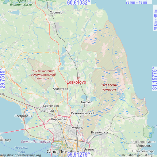
Leskolovo GPS coordinates[2]
60° 15' 48.276" North, 30° 27' 16.632" East
| Map corner | latitude | longitude |
|---|---|---|
| Upper-left | 60.61032°, | 29.7515° |
| Center: | 60.26341°, | 30.45462° |
| Lower-right: | 59.91279°, | 31.15775° |
| Map W x H: | 77.6×77.6 km | = 48.2×48.2mi |
| max Lat: | 73.50819° ⇑8.5% North |
| Leskolovo: | 60.26341° |
| min Lat: | ⇓91.5% South 41.28413° |
| min Long | Leskolovo | max Long |
| -179.12198° | 30.45462° | 179.35046° |
| W 4.6%⇐ | ⇒95.4% E |
Elevation
Elevation of Leskolovo is 75 m = 246 ft, and this is 127.6 m = 419 ft below average elevation for this country.
| Max E: |
2518 m = 8261 ft | 78.7% |
| Avg. | 202.6 m = 665 ft | |
| Leskolovo | 75 m = 246 ft | |
Min E: |
-28 m = -92 ft | 21.3% |
See also: Russia elevation on elevation.city.
Geographical zone
Leskolovo is located in North temperate zone (between Tropic of Cancer and the Arctic Circle). Distance of this North polar circle is 700.5 km =435.3 mi to North.| Distance of | km | miles | from Leskolovo |
|---|---|---|---|
| North Pole | 3306.4 | 2054.5 | to North |
| Arctic Circle | 700.5 | 435.3 | to North |
| Tropic Cancer | 4094.7 | 2544.3 | to South |
| Equator | 6700.7 | 4163.6 | to South |


Nearby cities:
15 places around Leskolovo: (largest is in red/bold)
• Agalatovo
11.1 km =6.9 mi,  243°
243°
• Bugry
21.6 km =13.4 mi,  189°
189°
• Garbolovo
8.9 km =5.5 mi,  14°
14°
• Kuyvozi
6.3 km =3.9 mi,  350°
350°
• Levashovo
22.4 km =13.9 mi,  217°
217°
• Luppolovo
15.5 km =9.6 mi, 218°
• Novoye Devyatkino
22.3 km =13.9 mi,  175°
175°
• Osel’ki
6.9 km =4.3 mi,  160°
160°
• Parnas
22.3 km =13.9 mi,  195°
195°
• Pesochnyy
22.4 km =13.9 mi,  225°
225°
• Sertolovo
19.2 km =11.9 mi, 226°
• Toksovo
12.7 km =7.9 mi, 164°
• Vaskelovo
15.7 km =9.8 mi,  339°
339°
• Verkhniye Osel’ki
1.6 km =1 mi, 190°
• Yukki
19.4 km =12.1 mi,  208°
208°
Sources, notices
• [Note1] Compared only with cities in Russia existing in our database
• [Src1] Map data: © OpenStreetMap contributors (CC-BY-SA)
• [Src2] Other city data from geonames.org with taken over terms of usage.
• [Src3] Geographical zone / Annual Mean Temperature by Robert A. Rohde @ Wikipedia
