Kambileyevskoye geodata
Kambileyevskoye (North Ossetia) is a populated place; located in Russia in Europe/Moscow (GMT+3) time zone. With population of 7,770 people, there are 1861 cities with bigger population in this country. Compared to other cities in Russia, 97.3% of cities are located further ↑North; 50.7% of cities are located further →East and 95% of cities have lower elevation than Kambileyevskoye. Note1


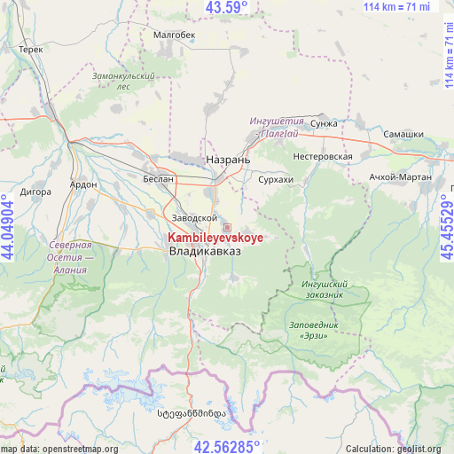
Kambileyevskoye GPS coordinates[2]
43° 4' 42.888" North, 44° 45' 7.776" East
| Map corner | latitude | longitude |
|---|---|---|
| Upper-left | 43.59°, | 44.04904° |
| Center: | 43.07858°, | 44.75216° |
| Lower-right: | 42.56285°, | 45.45529° |
| Map W x H: | 114.2×114.2 km | = 71×71mi |
| max Lat: | 73.50819° ⇑97.3% North |
| Kambileyevskoye: | 43.07858° |
| min Lat: | ⇓2.7% South 41.28413° |
| min Long | Kambileyevskoye | max Long |
| -179.12198° | 44.75216° | 179.35046° |
| W 49.3%⇐ | ⇒50.7% E |
Elevation
Elevation of Kambileyevskoye is 632 m = 2073 ft, and this is 429.4 m = 1409 ft above average elevation for this country.
| Max E: |
2518 m = 8261 ft | 5% |
| Kambileyevskoye | 632 m 2073 ft | |
| Avg. | 202.6 m = 665 ft | |
Min E: |
-28 m = -92 ft | 95% |
See also: Russia elevation on elevation.city.
Geographical zone
Kambileyevskoye is located in North temperate zone (between Tropic of Cancer and the Arctic Circle). Distance of this Northern Tropic circle is 2184 km =1357.1 mi to South.| Distance of | km | miles | from Kambileyevskoye |
|---|---|---|---|
| North Pole | 5217.2 | 3241.8 | to North |
| Arctic Circle | 2611.3 | 1622.6 | to North |
| Tropic Cancer | 2184 | 1357.1 | to South |
| Equator | 4789.9 | 2976.3 | to South |


Nearby cities:
15 places around Kambileyevskoye: (largest is in red/bold)
• Ali-Yurt
10.8 km =6.7 mi,  48°
48°
• Chermen
8.8 km =5.5 mi,  338°
338°
• Dachnoye
1.5 km =0.9 mi,  297°
297°
• Ekazhevo
15.9 km =9.9 mi,  21°
21°
• Galashki
19.8 km =12.3 mi,  77°
77°
• Gizel’
15.3 km =9.5 mi,  253°
253°
• Kantyshevo
19.2 km =11.9 mi,  329°
329°
• Magas
16.1 km =10 mi,  5°
5°
• Mikhaylovskoye
10.1 km =6.3 mi,  283°
283°
• Nazran’
16.5 km =10.3 mi, 5°
• Nogir
9.4 km =5.8 mi,  272°
272°
• Sunzha
6.2 km =3.9 mi,  111°
111°
• Surkhakhi
17.2 km =10.7 mi, 45°
• Tarskoye
12.7 km =7.9 mi,  171°
171°
• Vladikavkaz
8.3 km =5.2 mi,  235°
235°
Sources, notices
• [Note1] Compared only with cities in Russia existing in our database
• [Src1] Map data: © OpenStreetMap contributors (CC-BY-SA)
• [Src2] Other city data from geonames.org with taken over terms of usage.
• [Src3] Geographical zone / Annual Mean Temperature by Robert A. Rohde @ Wikipedia
