Shkurinskaya geodata
Shkurinskaya (Krasnodarskiy) is a populated place; located in Russia in Europe/Moscow (GMT+3) time zone. With population of 5,005 people, there are 2653 cities with bigger population in this country. Compared to other cities in Russia, 82.8% of cities are located further ↑North; 70.7% of cities are located further →East and 96.8% of cities have higher elevation than Shkurinskaya. Note1


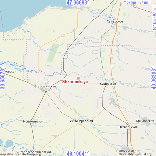
Shkurinskaya GPS coordinates[2]
46° 35' 8.88" North, 39° 21' 35.64" East
| Map corner | latitude | longitude |
|---|---|---|
| Upper-left | 47.06688°, | 38.65678° |
| Center: | 46.5858°, | 39.3599° |
| Lower-right: | 46.10041°, | 40.06303° |
| Map W x H: | 107.5×107.5 km | = 66.8×66.8mi |
| max Lat: | 73.50819° ⇑82.8% North |
| Shkurinskaya: | 46.5858° |
| min Lat: | ⇓17.2% South 41.28413° |
| min Long | Shkurinskaya | max Long |
| -179.12198° | 39.3599° | 179.35046° |
| W 29.3%⇐ | ⇒70.7% E |
Elevation
Elevation of Shkurinskaya is 8 m = 26 ft, and this is 194.6 m = 638 ft below average elevation for this country.
| Max E: |
2518 m = 8261 ft | 96.8% |
| Avg. | 202.6 m = 665 ft | |
| Shkurinskaya | 8 m = 26 ft | |
Min E: |
-28 m = -92 ft | 3.2% |
See also: Russia elevation on elevation.city.
Geographical zone
Shkurinskaya is located in North temperate zone (between Tropic of Cancer and the Arctic Circle). Distance of this North polar circle is 2221.3 km =1380.3 mi to North.| Distance of | km | miles | from Shkurinskaya |
|---|---|---|---|
| North Pole | 4827.2 | 2999.5 | to North |
| Arctic Circle | 2221.3 | 1380.3 | to North |
| Tropic Cancer | 2573.9 | 1599.3 | to South |
| Equator | 5179.9 | 3218.6 | to South |


Nearby cities:
15 places around Shkurinskaya: (largest is in red/bold)
• Atamanskaya
50.1 km =31.1 mi,  155°
155°
• Kanelovskaya
12.7 km =7.9 mi,  271°
271°
• Kislyakovskaya
28.9 km =18 mi,  123°
123°
• Krasnoye
23 km =14.3 mi,  42°
42°
• Krylovskaya
53.1 km =33 mi,  184°
184°
• Kushchëvskaya
21 km =13 mi,  97°
97°
• Leningradskaya
29.5 km =18.3 mi, 175°
• Novobataysk
47.3 km =29.4 mi, 42°
• Novoderevyankovskaya
55.3 km =34.4 mi,  238°
238°
• Novominskaya
42.9 km =26.7 mi,  225°
225°
• Novoplatnirovskaya
53.5 km =33.2 mi, 175°
• Peshkovo
48.2 km =30 mi,  2°
2°
• Samarskoye
46.4 km =28.8 mi,  32°
32°
• Starominskaya
24.5 km =15.2 mi,  255°
255°
• Staroshcherbinovskaya
52.6 km =32.7 mi,  275°
275°
Sources, notices
• [Note1] Compared only with cities in Russia existing in our database
• [Src1] Map data: © OpenStreetMap contributors (CC-BY-SA)
• [Src2] Other city data from geonames.org with taken over terms of usage.
• [Src3] Geographical zone / Annual Mean Temperature by Robert A. Rohde @ Wikipedia
